South Dakota Highway 153
| ||||
|---|---|---|---|---|
 | ||||
| Route information | ||||
| Defined by SDCL §31-4-199 | ||||
| Maintained by SDDOT | ||||
| Length | 2.369 mi[1] (3.813 km) | |||
| Major junctions | ||||
| South end |
| |||
| North end |
| |||
| Location | ||||
| Counties | Yankton | |||
| Highway system | ||||
| ||||

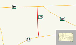
South Dakota Highway 153 (SD 153) is a state highway in the U.S. state of South Dakota. It is entirely in Yankton County and runs from SD 52 to SD 50. The route is maintained by the South Dakota Department of Transportation (SDDOT), and is not part of the National Highway System.
Route description
SD 153 starts at an intersection with SD 52 west of the city of Yankton and travels in a northwest direction through a residential area. The route bends to the north and continues in that direction through rolling farmland. The highway meets its northern terminus a short distance later at SD 50.[2][3]
SD 153 is maintained by SDDOT. In 2012, the traffic on the highway was measured in average annual daily traffic, and SD 153 had an average of 610 vehicles.[1] The route is not a part of the National Highway System,[4] a system of highways important to the nation's defense, economy, and mobility.[5]
Major intersections
The entire route is in Yankton County.
| Location | mi[1] | km | Destinations | Notes | |
|---|---|---|---|---|---|
| | 0.000 | 0.000 | Southern terminus of SD 153; roadway continues as Shore Drive. | ||
| | 2.369 | 3.813 | Northern terminus; roadway continues as 435th Avenue. | ||
| 1.000 mi = 1.609 km; 1.000 km = 0.621 mi | |||||
References
- 1 2 3 "State Highway Log" (PDF). South Dakota Department of Transportation. January 2012. Retrieved March 3, 2013.
- ↑ Google (March 3, 2013). "South Dakota Highway 153" (Map). Google Maps. Google. Retrieved March 3, 2013.
- ↑ South Dakota Atlas & Gazetteer. Yarmouth, ME: DeLorme. 2009. p. 69. ISBN 0-89933-330-3.
- ↑ National Highway System: South Dakota (PDF) (Map). Federal Highway Administration. October 1, 2012. Retrieved March 3, 2013.
- ↑ Natzke, Stefan; Neathery, Mike; Adderly, Kevin (September 26, 2012). "What is the National Highway System?". National Highway System. Federal Highway Administration. Retrieved March 3, 2013.
External links
Route map: