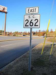
South Carolina Highway 262
| ||||
|---|---|---|---|---|
| Leesburg Road | ||||
 | ||||
| Route information | ||||
| Maintained by SCDOT | ||||
| Length | 14.8 mi[1] (23.7 km) | |||
| Existed | 1940 – present | |||
| Major junctions | ||||
| West end |
| |||
|
| ||||
| East end |
| |||
| Location | ||||
| Counties | Richland | |||
| Highway system | ||||
| ||||

South Carolina Highway 262 (SC 262) is a primary state highway in the U.S. state of South Carolina. It serves primarily as the southern border of Fort Jackson.
Route description
Starting from Garners Ferry Road, U.S. Route 76 (US 76) and US 378, it connects with Interstate 77 (I-77) before continuing on a relatively straight two-lane road to US 601.[2]
History
Established in 1937 or 1938 as a new primary route going east, it started off as a seven miles (11 km) paved stub road, going east from US 76. In 1940, it was extended along a dirt road to US 601; which was later paved by 1942. In 1948, it was briefly decommissioned, but reinstated a year later. Since its inception, it has served as the southern boundary for Fort Jackson for its entire length.[3]
Junction list
The entire route is in Richland County.
| Location | mi[1] | km | Destinations | Notes | |
|---|---|---|---|---|---|
| Columbia | 0.00 | 0.00 | |||
| 0.08– 0.32 | 0.13– 0.51 | Exit 9 (I-77); access to I-77 southbound via US 76/US 378 | |||
| Leesburg | 14.75 | 23.74 | |||
| 1.000 mi = 1.609 km; 1.000 km = 0.621 mi | |||||
References
- 1 2 "Statewide Highways (shapefile)" (zip). South Carolina Department of Transportation. September 29, 2017. Retrieved December 8, 2017.
- ↑ Google (November 23, 2012). "South Carolina Highway 262" (Map). Google Maps. Google. Retrieved November 23, 2012.
- ↑ "Mapmikey's South Carolina Highways Page (SC 260-269)". Retrieved November 23, 2012.
External links
Route map:
