Souder, Missouri
| Souder, Missouri | |
|---|---|
| Community | |
 Souder, Missouri Location of Souder, Missouri | |
| Coordinates: 36°47′38″N 92°27′31″W / 36.79389°N 92.45861°WCoordinates: 36°47′38″N 92°27′31″W / 36.79389°N 92.45861°W[1] | |
| Country | U. S. A. |
| State | Missouri |
| County | Ozark County |
| Elevation[1] | 260 m (850 ft) |
| Time zone | UTC-6 (CST) |
| • Summer (DST) | UTC-5 (CDT) |
Souder is an unincorporated community on Spring Creek in northern Ozark County, Missouri.[2] It is thirteen miles north of Gainesville and is located on county road 142 north of Route 95.
A post office was established at Souder in 1903, and remained in operation until 1988.[3][4] G. W. Souder, an early postmaster, gave the community his last name.[5]
References
- 1 2 Rockbridge, Missouri, 7.5 Minute Topographic Quadrangle, USGS, 1973
- ↑ U.S. Geological Survey Geographic Names Information System: Souder
- ↑ "Post Offices". Jim Forte Postal History. Retrieved 27 November 2016.
- ↑ Ozark County post offices
- ↑ "Ozark County Place Names, 1928–1945". The State Historical Society of Missouri. Archived from the original on June 24, 2016. Retrieved November 27, 2016.
Municipalities and communities of Ozark County, Missouri, United States | ||
|---|---|---|
| Cities | 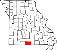 | |
| Villages | ||
| Townships |
| |
| CDPs | ||
| Other unincorporated communities | ||
| Ghost towns | ||
This article is issued from
Wikipedia.
The text is licensed under Creative Commons - Attribution - Sharealike.
Additional terms may apply for the media files.