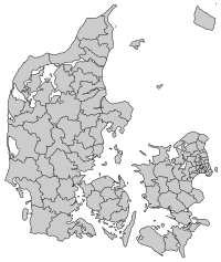
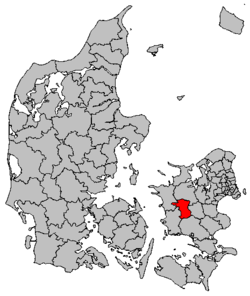
Sorø Municipality
| Sorø Municipality Sorø Kommune | ||
|---|---|---|
| Municipality | ||
| ||
 | ||
| Country | Denmark | |
| Region | Region Zealand | |
| Seat | Sorø | |
| Government | ||
| • Mayor | Gert Jørgensen (C) | |
| Area | ||
| • Total | 311.05 km2 (120.10 sq mi) | |
| Population (1 January 1, 2012) | ||
| • Total | 29,400 | |
| • Density | 95/km2 (240/sq mi) | |
| Time zone | UTC+1 (CET) | |
| • Summer (DST) | UTC+2 (CEST) | |
| Island | Zealand | |
| Municipal code | 340 | |
| Website | www.soroe.dk | |

Sorø Municipality is a municipality (Danish, kommune) in Region Sjælland on the island of Zealand (Sjælland) in east Denmark. The municipality covers an area of 317 km2 (122 sq mi), and has a total population of 29,331 (2015).[1] The main town and the site of its municipal council is the town of Sorø. Other towns in the municipality are Dianalund, Stenlille, and Ruds Vedby.
On 1 January 2007 Sorø municipality was, as the result of Kommunalreformen ("The Municipal Reform" of 2007), merged with existing Dianalund and Stenlille municipalities to form the new Sorø municipality.
Urban areas
The ten largest urban areas in the municipality are:[1]
| # | Locality | Population (2015) |
|---|---|---|
| 1 | Sorø | 7,754 |
| 2 | Dianalund | 4,003 |
| 3 | Frederiksberg | 3,461 |
| 4 | Stenlille | 2,073 |
| 5 | Ruds Vedby | 1,716 |
| 6 | Fjenneslev | 795 |
| 7 | Nyrup | 422 |
| 8 | Munke Bjergby | 315 |
| 9 | Vedde | 302 |
| 10 | Tersløse | 250 |
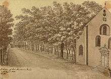
The city of Sorø
The city of Sorø has a population of 7,754 (2015)[1] and is the site of both the municipal council and the county council. It was scheduled to be regional seat for Region Sjælland, one of the five new regions to be implantated in Denmark 1 January 2007.
While by no means the biggest city in Denmark, it has great historical value. It was founded in 1161 by Bishop Absalon, later the founder of Copenhagen, and is the site of Sorø Academy (Danish Sorø Akademi) and Sorø Klosterkirke, the church where Absalon is buried, along with other notable Danes, including royalty. Queen Margaret I of Denmark was buried at this church until moved to Roskilde Cathedral in Roskilde.
Image gallery
.JPG)
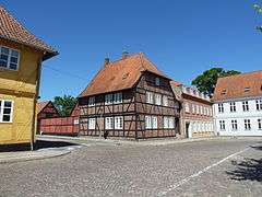 Central Sorø
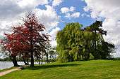 The shore of the lake
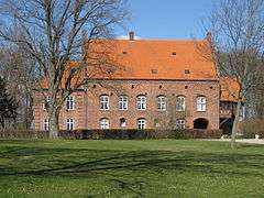
References
- Municipal statistics: NetBorger Kommunefakta, delivered from KMD a.k.a. Kommunedata (Municipal Data)
- Municipal mergers and neighbors: Eniro new municipalities map
- 1 2 3 "Statistikbanken". Danmarks Statistik. Retrieved 2015-12-22.
External links
| Wikimedia Commons has media related to Sorø Kommune. |