Soap Creek Township, Davis County, Iowa
| Soap Creek Township | |
|---|---|
| Township | |
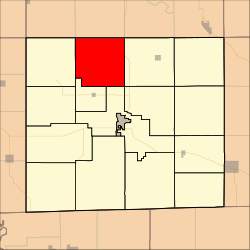 Location in Davis County | |
| Coordinates: 40°51′47″N 92°28′11″W / 40.86306°N 92.46972°WCoordinates: 40°51′47″N 92°28′11″W / 40.86306°N 92.46972°W | |
| Country |
|
| State |
|
| County | Davis |
| Area | |
| • Total | 34.9 sq mi (90.38 km2) |
| • Land | 34.85 sq mi (90.25 km2) |
| • Water | 0.05 sq mi (0.13 km2) 0.14% |
| Elevation | 814 ft (248 m) |
| Population (2000) | |
| • Total | 610 |
| • Density | 17.5/sq mi (6.8/km2) |
| GNIS feature ID | 0468724 |
Soap Creek Township is a township in Davis County, Iowa, USA. As of the 2000 census, its population was 610.
History
Soap Creek Township was organized in 1846.[1] It took its name from Soap Creek.[2]
Geography
Soap Creek Township covers an area of 34.9 square miles (90.38 square kilometers); of this, 0.05 square miles (0.13 square kilometers) or 0.14 percent is water. The stream of Bear Creek runs through this township.
Unincorporated towns
- Belknap
- Carbon
(This list is based on USGS data and may include former settlements.)
Adjacent townships
- Green Township, Wapello County (north)
- Keokuk Township, Wapello County (northeast)
- Lick Creek Township (east)
- Cleveland Township (southeast)
- Perry Township (southeast)
- Drakesville Township (south)
- Marion Township (west)
- Adams Township, Wapello County (northwest)
Cemeteries
The township contains eight cemeteries: Baer, Breeding, Harbour, Kingdom, Rime, Roland, Rudd and Sherman Chapel.
Major highways
References
- ↑ History of Davis County, Iowa. State Historical Company. 1882. p. 428.
- ↑ History of Davis County, Iowa: Containing a History of the County, Its Cities, Towns, Etc. State Historical Company. 1882. p. 598.
External links
Municipalities and communities of Davis County, Iowa, United States | ||
|---|---|---|
| Cities | ||
| Townships | ||
| Unincorporated community | ||
This article is issued from
Wikipedia.
The text is licensed under Creative Commons - Attribution - Sharealike.
Additional terms may apply for the media files.