Slatenik
| Slatenik | |
|---|---|
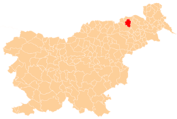
 Slatenik Location in Slovenia | |
| Coordinates: 46°37′5.02″N 15°44′12.54″E / 46.6180611°N 15.7368167°ECoordinates: 46°37′5.02″N 15°44′12.54″E / 46.6180611°N 15.7368167°E | |
| Country |
|
| Traditional region | Styria |
| Statistical region | Drava |
| Municipality | Pesnica |
| Area | |
| • Total | 0.35 km2 (0.14 sq mi) |
| Elevation | 287.1 m (941.9 ft) |
| Population (2002) | |
| • Total | 40 |
| [1] | |
Slatenik (pronounced [ˈslaːtɛnik]) is a small dispersed settlement in the Municipality of Pesnica in northeastern Slovenia. It lies in the Slovene Hills (Slovene: Slovenske gorice) north of the local road from Vosek to Spodnji Jakobski Dol. Traditionally the area was part of the Styria region. The municipality is now included in the Drava Statistical Region.[2]
References
External links
| Settlements | Administrative centre: Pesnica pri Mariboru
|  |
|---|---|---|
| Landmarks |
| |
This article is issued from
Wikipedia.
The text is licensed under Creative Commons - Attribution - Sharealike.
Additional terms may apply for the media files.