Ranca, Pesnica
| Ranca | |
|---|---|
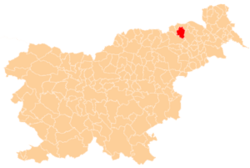
 Ranca Location in Slovenia | |
| Coordinates: 46°37′31.46″N 15°40′9.39″E / 46.6254056°N 15.6692750°ECoordinates: 46°37′31.46″N 15°40′9.39″E / 46.6254056°N 15.6692750°E | |
| Country |
|
| Traditional region | Styria |
| Statistical region | Drava |
| Municipality | Pesnica |
| Area | |
| • Total | 1.58 km2 (0.61 sq mi) |
| Elevation | 270.8 m (888.5 ft) |
| Population (2002) | |
| • Total | 237 |
| [1] | |
Ranca (pronounced [ˈɾaːntsa]) is a settlement in the Municipality of Pesnica in northeastern Slovenia. It lies in the Slovene Hills (Slovene: Slovenske gorice) just west of the old regional road from Maribor to Šentilj. The motorway bypasses the settlement to the west and the main railway line runs along the eastern boundary of the settlement. Traditionally the area was part of Styria. The municipality is now included in the Drava Statistical Region.[2]
References
External links
| Settlements | Administrative centre: Pesnica pri Mariboru
|  |
|---|---|---|
| Landmarks |
| |
This article is issued from
Wikipedia.
The text is licensed under Creative Commons - Attribution - Sharealike.
Additional terms may apply for the media files.