Sipsey River
| Sipsey River | |
|---|---|
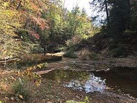 Sipsey River in the 2016 drought | |
| Physical characteristics | |
| Main source | 33°54′52″N 87°41′14″W / 33.91454°N 87.68724°W |
| River mouth | 33°00′14″N 88°10′19″W / 33.00401°N 88.17197°WCoordinates: 33°00′14″N 88°10′19″W / 33.00401°N 88.17197°W |
The Sipsey River is a 145-mile-long (233 km)[1] swampy low-lying river in west central Alabama. The Sipsey is surrounded by some exceptional wetland habitat. It originates near Glen Allen, and discharges into the Tombigbee River near Vienna.[2]
References
- ↑ "The National Map". U.S. Geological Survey. Retrieved Feb 23, 2011.
- ↑ U.S. Geological Survey Geographic Names Information System: Sipsey River
This article is issued from
Wikipedia.
The text is licensed under Creative Commons - Attribution - Sharealike.
Additional terms may apply for the media files.