Sipaulovi, Arizona
| Sipaulovi, Arizona | |
|---|---|
| Populated place | |
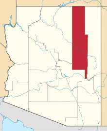
 Sipaulovi Location within the state of Arizona  Sipaulovi Sipaulovi (the US) | |
| Coordinates: 35°48′30″N 110°29′46″W / 35.80833°N 110.49611°WCoordinates: 35°48′30″N 110°29′46″W / 35.80833°N 110.49611°W | |
| Country | United States |
| State | Arizona |
| County | Navajo |
| Elevation[1] | 6,312 ft (1,924 m) |
| Time zone | UTC-7 (Mountain (MST)) |
| • Summer (DST) | UTC-7 (MST) |
| Area code(s) | 928 |
| FIPS code | 04-67230 |
| GNIS feature ID | 11227 |
Sipaulovi is a populated place situated on the Hopi Reservation within the Second Mesa CDP in Navajo County, Arizona.[2] It has been known by numerous names over the years, including: Ah-le-la, Ahela, Ci-pau-lo-vi, Sha-pah-la, Sha-pah-lah-lwee, Shi-pau-i-luvi, Shi-paui-i-luvi, Shipaulavi, Shipaulovi, Shipolia, and Shipowlawe. Historically, it has had two official names, both as a result of decisions by the Board on Geographic Names. In 1915, the Board officially named the settlement, Shipolovi, but in 1988 they changed the official name to its current Sipaulovi. It was settled in approximately 1750 by settlers who were fleeing from a mosquito infestation. In Hopi sipaulovi refers to mosquitos. It has an estimated elevation of 6,312 feet (1,924 m) above sea level.[1]
References
- 1 2 "Feature Detail Report for: Sipaulovi". Geographic Names Information System. United States Geological Survey.
- ↑ "Sipaulovi (in Navajo County, AZ) Populated Place Profile". AZ Hometown Locator. Retrieved March 28, 2017.