Silvino Lobos, Northern Samar
| Silvino Lobos | |
|---|---|
| Municipality | |
| Municipality of Silvino Lobos | |
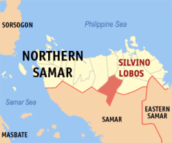 Map of Northern Samar with Silvino Lobos highlighted | |
.svg.png) Silvino Lobos Location within the Philippines | |
| Coordinates: 12°18′N 124°50′E / 12.3°N 124.83°ECoordinates: 12°18′N 124°50′E / 12.3°N 124.83°E | |
| Country |
|
| Region | Eastern Visayas (Region VIII) |
| Province | Northern Samar |
| District | 2nd District |
| Founded | 1965 |
| Barangays | 26 (see Barangays) |
| Government [1] | |
| • Type | Sangguniang Bayan |
| • Mayor | Remedios Tilbe-Espinar |
| • Vice Mayor | Totong Jarito |
| • Electorate | 9,251 voters (2016) |
| Area [2] | |
| • Total | 224.20 km2 (86.56 sq mi) |
| Population (2015 census)[3] | |
| • Total | 15,299 |
| • Density | 68/km2 (180/sq mi) |
| Time zone | UTC+8 (PST) |
| ZIP code | 6414 |
| PSGC | 084822000 |
| IDD : area code | +63 (0)55 |
| Climate type | Tropical rainforest climate |
| Income class | 4th municipal income class |
| Revenue (₱) | 70,823,420.37 (2016) |
| Native languages |
Waray Tagalog |
Silvino Lobos, officially the Municipality of Silvino Lobos, is a 4th class municipality in the province of Northern Samar, Philippines. According to the 2015 census, it has a population of 15,299 people.[3]
It is a former barrio of the town of Pambujan. Its former name is Barrio Suba until it became a town in 1965.
Barangays
Silvino Lubos is politically subdivided into 26 barangays.
- Balud
- Cababayogan
- Cabunga-an
- Cagda-o
- Caghilot
- Camanggaran
- Camaya-an
- Deit De Suba
- Deit De Turag
- Gebonawan
- Gebolwangan
- Gecbo-an
- Giguimitan
- Genagasan
- Geparayan De Turag
- Gusaran
- Imelda
- Montalban
- Suba (Poblacion)
- San Isidro
- Senonogan de Tubang
- Tobgon
- Victory
- Poblacion I
- Poblacion II
- San Antonio
Demographics
| Population census of Silvino Lubos | ||
|---|---|---|
| Year | Pop. | ±% p.a. |
| 1970 | 6,497 | — |
| 1975 | 7,633 | +3.28% |
| 1980 | 7,245 | −1.04% |
| 1990 | 9,071 | +2.27% |
| 1995 | 11,028 | +3.73% |
| 2000 | 12,645 | +2.98% |
| 2007 | 13,761 | +1.17% |
| 2010 | 14,303 | +1.42% |
| 2015 | 15,299 | +1.29% |
| Source: Philippine Statistics Authority[3][4][5][6] | ||
References
- ↑ "Municipality". Quezon City, Philippines: Department of the Interior and Local Government. Retrieved 31 May 2013.
- ↑ "Province: Northern Samar". PSGC Interactive. Quezon City, Philippines: Philippine Statistics Authority. Retrieved 12 November 2016.
- 1 2 3 Census of Population (2015). "Region VIII (Eastern Visayas)". Total Population by Province, City, Municipality and Barangay. PSA. Retrieved 20 June 2016.
- ↑ Census of Population and Housing (2010). "Region VIII (Eastern Visayas)". Total Population by Province, City, Municipality and Barangay. NSO. Retrieved 29 June 2016.
- ↑ Censuses of Population (1903–2007). "Region VIII (Eastern Visayas)". Table 1. Population Enumerated in Various Censuses by Province/Highly Urbanized City: 1903 to 2007. NSO.
- ↑ "Province of Northern Samar". Municipality Population Data. Local Water Utilities Administration Research Division. Retrieved 17 December 2016.
External links
- Philippine Standard Geographic Code
- Philippine Census Information
- Local Governance Performance Management System
Places adjacent to Silvino Lobos, Northern Samar | ||||||||||
|---|---|---|---|---|---|---|---|---|---|---|
| ||||||||||
Catarman (capital) | |
| Municipalities | |
This article is issued from
Wikipedia.
The text is licensed under Creative Commons - Attribution - Sharealike.
Additional terms may apply for the media files.