Silverton, Pretoria
| Silverton | |
|---|---|
 Silverton  Silverton Silverton (South Africa)  Silverton Silverton (Africa) | |
| Coordinates: 25°43′54″S 28°18′20″E / 25.73167°S 28.30556°ECoordinates: 25°43′54″S 28°18′20″E / 25.73167°S 28.30556°E | |
| Country | South Africa |
| Province | Gauteng |
| Municipality | City of Tshwane |
| Main Place | Pretoria |
| Area[1] | |
| • Total | 4.38 km2 (1.69 sq mi) |
| Population (2011)[1] | |
| • Total | 9,590 |
| • Density | 2,200/km2 (5,700/sq mi) |
| Racial makeup (2011)[1] | |
| • Black African | 40.1% |
| • Coloured | 9.0% |
| • Indian/Asian | 1.6% |
| • White | 48.0% |
| • Other | 1.5% |
| First languages (2011)[1] | |
| • Afrikaans | 52.6% |
| • English | 15.3% |
| • Northern Sotho | 6.4% |
| • Southern Sotho | 5.1% |
| • Other | 20.6% |
| Time zone | UTC+2 (SAST) |
| Postal code (street) | 0084 |
| PO box | n/a |
| Area code | 012 |
Silverton is an eastern suburb of Pretoria, South Africa. It lies wedged between the slopes of the Magaliesberg mountain range.
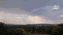
Rain showers over Silverton in Pretoria.
References
- 1 2 3 4 "Sub Place Silverton". Census 2011.
.svg.png)
This article is issued from
Wikipedia.
The text is licensed under Creative Commons - Attribution - Sharealike.
Additional terms may apply for the media files.