Sidney Township, Champaign County, Illinois
| Sidney Township | |
|---|---|
| Township | |
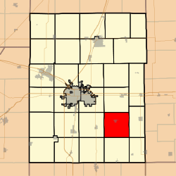 Location in Champaign County | |
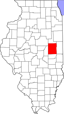 Champaign County's location in Illinois | |
| Coordinates: 40°00′38″N 88°03′59″W / 40.01056°N 88.06639°WCoordinates: 40°00′38″N 88°03′59″W / 40.01056°N 88.06639°W | |
| Country | United States |
| State | Illinois |
| County | Champaign |
| Established | November 8, 1859 |
| Area | |
| • Total | 36.44 sq mi (94.4 km2) |
| • Land | 36.32 sq mi (94.1 km2) |
| • Water | 0.12 sq mi (0.3 km2) 0.33% |
| Elevation | 669 ft (204 m) |
| Population (2010) | |
| • Estimate (2016)[1] | 1,708 |
| • Density | 47.7/sq mi (18.4/km2) |
| Time zone | UTC-6 (CST) |
| • Summer (DST) | UTC-5 (CDT) |
| FIPS code | 17-019-69888 |
Sidney Township is a township in Champaign County, Illinois, USA. As of the 2010 census, its population was 1,733 and it contained 715 housing units.[2]
Geography
According to the 2010 census, the township has a total area of 36.44 square miles (94.4 km2), of which 36.32 square miles (94.1 km2) (or 99.67%) is land and 0.12 square miles (0.31 km2) (or 0.33%) is water.[2] The stream of Rush Branch runs through this township. The Salt Fork of the Vermilion River winds its way through the northern sections of the township. Frito-Lay has a large corn handling facility located in section 12 (40°1′50″N 88°1′34″W / 40.03056°N 88.02611°W) along the county highway between Sidney and Homer; it sits near a major Norfolk Southern east-west rail line.

Cities and towns
Unincorporated towns
(This list is based on USGS data and may include former settlements.)
Cemeteries
The township contains six cemeteries: Bliss, Boys Family, Brownfield, Brumley, Lynn Grove and Mount Hope.
Airports and landing strips
- Justus Airport
Demographics
| Historical population | |||
|---|---|---|---|
| Census | Pop. | %± | |
| Est. 2016 | 1,708 | [1] | |
| U.S. Decennial Census[3] | |||
References
- "Sidney Township, Champaign County, Illinois". Geographic Names Information System. United States Geological Survey. Retrieved 2010-01-04.
- United States Census Bureau cartographic boundary files
- 1 2 "Population and Housing Unit Estimates". Retrieved June 9, 2017.
- 1 2 "Population, Housing Units, Area, and Density: 2010 - County -- County Subdivision and Place -- 2010 Census Summary File 1". United States Census. Retrieved 2013-05-28.
- ↑ "Census of Population and Housing". Census.gov. Retrieved June 4, 2016.
External links
Places adjacent to Sidney Township, Champaign County, Illinois | |
|---|---|
Municipalities and communities of Champaign County, Illinois, United States | ||
|---|---|---|
| Cities | ||
| Villages | ||
| Townships | ||
| CDPs | ||
| Other unincorporated communities | ||
| Footnotes | ‡This populated place also has portions in an adjacent county or counties | |