Savoy, Illinois
| Savoy | |
|---|---|
| Village | |
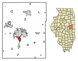 Location of Savoy in Champaign County, Illinois. | |
 Savoy Location within Champaign County  Savoy Savoy (Illinois) | |
| Coordinates: 40°3′48″N 88°15′9″W / 40.06333°N 88.25250°WCoordinates: 40°3′48″N 88°15′9″W / 40.06333°N 88.25250°W | |
| Country | United States |
| State | Illinois |
| County | Champaign |
| Area[1] | |
| • Total | 3.34 sq mi (8.64 km2) |
| • Land | 3.28 sq mi (8.48 km2) |
| • Water | 0.06 sq mi (0.16 km2) |
| Population (2010) | |
| • Total | 7,280 |
| • Estimate (2016)[2] | 8,177 |
| • Density | 2,496.03/sq mi (963.74/km2) |
| Time zone | UTC-6 (CST) |
| • Summer (DST) | UTC-5 (CDT) |
| Postal code | 61874 |
| Area code(s) | 217 |
| FIPS code | 17-67860 |
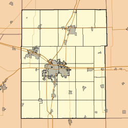
Savoy is a village in Champaign County, Illinois, United States. The population was 7,280 at the 2010 census.
The village was named after Princess Maria Clotilde of Savoy, who had paid the area a visit in 1861.[3]
Geography
Savoy is located at 40°3′48″N 88°15′9″W / 40.06333°N 88.25250°W (40.063441, −88.252388).[4]
According to the 2010 census, Savoy has a total area of 3.22 square miles (8.34 km2), of which 3.2 square miles (8.29 km2) (or 99.38%) is land and 0.02 square miles (0.05 km2) (or 0.62%) is water.[5]
Savoy shares a border with the neighboring city of Champaign and is less than two miles from the site of the main campus of the University of Illinois. Savoy is a part of the Champaign–Urbana metropolitan area.
Transportation
The northern part of Savoy and a corridor along Dunlap Avenue are serviced by the Champaign-Urbana Mass Transit District.
U.S. Route 45 (Dunlap Avenue) runs from Tolono, Illinois through Savoy into Champaign, Illinois at Neil Street. Savoy is about 2-3 miles east of, but in relative proximity to Interstate 57 with access via Curtis Road at Exit 232 and Monticello Road at Exit 229.
The University of Illinois Willard Airport (KCMI) that serves East Central Illinois, with commercial airline service to Chicago O'Hare Airport and other destinations, is located immediately south of Savoy.
Demographics
| Historical population | |||
|---|---|---|---|
| Census | Pop. | %± | |
| 1960 | 339 | — | |
| 1970 | 592 | 74.6% | |
| 1980 | 2,126 | 259.1% | |
| 1990 | 2,674 | 25.8% | |
| 2000 | 4,476 | 67.4% | |
| 2010 | 7,280 | 62.6% | |
| Est. 2016 | 8,177 | [2] | 12.3% |
| U.S. Decennial Census[6] | |||
At the 2000 census,[7] there were 4,476 people, 2,032 households and 1,127 families residing in the village. The population density was 2,899.9 per square mile (1,122.2/km²). There were 2,099 housing units at an average density of 1,359.9 per square mile (526.3/km²). The racial makeup of the village was 81.41% White, 4.51% African American, 0.16% Native American, 10.84% Asian, 0.04% Pacific Islander, 0.78% from other races, and 2.26% from two or more races. Hispanic or Latino of any race were 2.12% of the population.
There were 2,032 households, of which 26.1% had children under the age of 18 living with them, 48.2% were married couples living together, 5.8% had a female householder with no husband present, and 44.5% were non-families. Thirty-six and six tenths percent of all households were made up of individuals and 12.1% had someone living alone who was 65 years of age or older. The average household size was 2.14 and the average family size was 2.86.
Twenty-one and one tenth percent of the population were under the age of 18, 10.3% from 18 to 24, 34.6% from 25 to 44, 19.2% from 45 to 64, and 14.8% who were 65 years of age or older. The median age was 34 years. For every 100 females, there were 84.6 males. For every 100 females age 18 and over, there were 80.6 males.
The median household income was $48,500 and the median family income was $61,927. Males had a median income of $50,172 compared with $30,394 for females. The per capita income for the village was $25,949. About 5.7% of families and 9.1% of the population were below the poverty line, including 6.8% of those under age 18 and 1.2% of those age 65 or over.
References
- ↑ "2016 U.S. Gazetteer Files". United States Census Bureau. Retrieved Jun 30, 2017.
- 1 2 "Population and Housing Unit Estimates". Retrieved June 9, 2017.
- ↑ Illinois Central Magazine. Illinois Central Railroad Company. 1922. p. 46.
- ↑ "US Gazetteer files: 2010, 2000, and 1990". United States Census Bureau. 2011-02-12. Retrieved 2011-04-23.
- ↑ "G001 - Geographic Identifiers - 2010 Census Summary File 1". United States Census Bureau. Retrieved 2015-12-25.
- ↑ "Census of Population and Housing". Census.gov. Retrieved June 4, 2015.
- ↑ "American FactFinder". United States Census Bureau. Retrieved 2008-01-31.
External links
| Wikimedia Commons has media related to Savoy, Illinois. |
Municipalities and communities of Champaign County, Illinois, United States | ||
|---|---|---|
| Cities | ||
| Villages | ||
| Townships | ||
| CDPs | ||
| Other unincorporated communities | ||
| Footnotes | ‡This populated place also has portions in an adjacent county or counties | |