Shindand
| Shindand شينډنډ | |
|---|---|
 Shindand Location in Afghanistan | |
| Coordinates: 33°18′13″N 62°8′24″E / 33.30361°N 62.14000°ECoordinates: 33°18′13″N 62°8′24″E / 33.30361°N 62.14000°E | |
| Country |
|
| Province | Herat Province |
| District | Shindand District |
| Elevation | 3,497 ft (1,066 m) |
| Time zone | UTC+4:30 |
Shīnḍanḍ (Pashto: شينډنډ; Persian: شيندند) is a town and the center of the Shindand District, Herat Province, Afghanistan. It is located at 33°18′13″N 62°08′24″E / 33.3036°N 62.14°E at 1066 m altitude. The Shindand Air Base is located about 15 miles northeast of the town.
Shindand is at the northern end of Zirko Valley, which is one of main centers of poppy production in western Afghanistan. The town is located south of Adriskan, where a large police training facility exists. The population is mixed, includes Pashtuns, Tajiks and others, though Pashtuns make up the majority. The main languages spoken in the area are Pashto and Dari Persian. During the Soviet war in Afghanistan (1979-1989) the 5th Guards Motor Rifle Division was headquartered in the town.
Etymology
Climate
With an influence from the local steppe climate, Shindand features a cold semi-arid climate (BSk) under the Köppen climate classification. The average temperature in Shindand is 16.5 °C, while the annual precipitation averages 168 mm.
July is the hottest month of the year with an average temperature of 29.4 °C. The coldest month January has an average temperature of 4.1 °C.
| Climate data for Shindand | |||||||||||||
|---|---|---|---|---|---|---|---|---|---|---|---|---|---|
| Month | Jan | Feb | Mar | Apr | May | Jun | Jul | Aug | Sep | Oct | Nov | Dec | Year |
| Average high °C (°F) | 11.1 (52) |
13.3 (55.9) |
19.4 (66.9) |
24.1 (75.4) |
30.1 (86.2) |
35.8 (96.4) |
37.7 (99.9) |
36.3 (97.3) |
31.9 (89.4) |
25.8 (78.4) |
18.4 (65.1) |
13.1 (55.6) |
24.8 (76.5) |
| Daily mean °C (°F) | 4.1 (39.4) |
6.6 (43.9) |
12.1 (53.8) |
16.5 (61.7) |
21.8 (71.2) |
27.1 (80.8) |
29.4 (84.9) |
27.4 (81.3) |
22.5 (72.5) |
16.2 (61.2) |
9.4 (48.9) |
5.2 (41.4) |
16.5 (61.8) |
| Average low °C (°F) | −2.8 (27) |
−0.1 (31.8) |
4.9 (40.8) |
9.0 (48.2) |
13.5 (56.3) |
18.4 (65.1) |
21.1 (70) |
18.6 (65.5) |
13.1 (55.6) |
6.7 (44.1) |
0.4 (32.7) |
−2.6 (27.3) |
8.4 (47) |
| Source: Climate-Data.org[2] | |||||||||||||
Shindand Air Base
The Shindand Air Base is located about 15 miles to the northeast of the town, which currently occupied by Afghan and NATO's International Security Assistance Force. It is a former Soviet airfield, repaired by U.S. forces. The area is flat and arid, with foothills to the north and west. The Kandahar–Herat Highway, which is part of Afghanistan's Highway 1, passes next to the Shindand Air Base. A free medical clinic supported by the Afghan National Army (ANA) provides free medical care for the population of the town.
See also
- Zirkoh Azizabad airstrike
Notable people
Literature
- Louis Dupree, Afghanistan. 1st Edition: 1973; Ludwig W. Adamec, Historical Dictionary of Afghanistan, 3rd ed., 2003.
- S.I. Bruk, Narody Peredney Azii (1960); S.I. Bruk, and V. S. Apenchenko, Atlas Narodov Mira (Moscow: Academy of Science, 1964) A. Gabriel, Religionsgeographie von Persien (Vienna, 1971).
References
- ↑ L.W. Adamec, Historical And Political Gazetteer Of Afghanistan, Vol. 3, Herat and Northwestern Afghanistan, Akademische Druck-u. Verlagsanstalt, 1972, ISBN 978-3201009423, p. 343
- ↑ "Climate: Shindand - Climate-Data.org". Retrieved 9 September 2016.
External links
- Photo of Shindand market vendor Robert Lankenau, 2005-03-26
| Capital | 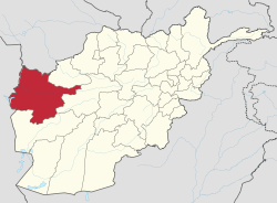 | |
|---|---|---|
| Districts | ||
| Cities |
| |
| Landmarks |
| |