Shemya
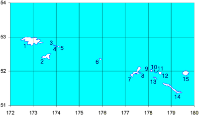
Shemya or Simiya (Aleut: Samiyax̂[1]) is a small island in the Near Islands group of the Semichi Islands chain in the Aleutian Islands archipelago southwest of Alaska, at 52°43′27″N 174°07′08″E / 52.72417°N 174.11889°ECoordinates: 52°43′27″N 174°07′08″E / 52.72417°N 174.11889°E. It has a land area of 5.903 sq mi (15.29 km2), and is about 1,200 miles (1,900 km) southwest of Anchorage, Alaska. It is 2.73 miles (4.39 km) wide and 4.32 miles (6.95 km) long.
History

The Russian vessel Saint Peter and Paul wrecked at Shemya in 1762. Most of the crew survived.
A United States Air Force radar, surveillance, and weather station and aircraft refueling station, including a 10,000 ft (3 km) long runway, opened on Shemya in 1943 and is still in operation. The station, originally Shemya Air Force Base or Shemya Station, had 1,500 workers at its peak in the 1960s. In 1956, Northwest Airlines leased Shemya Island from the U.S. government to use as a refueling station on their North Pacific route. According to Northwest's website, that made them "the first airline to operate its own airport."[2] Northwest was operating Lockheed Constellation L-1049G model propliners on its "Orient Express" service between the U.S. and Asia in 1956.[3]
The United States Air Force airborne intelligence platforms "Cobra Ball", "Rivet Amber," and "Rivet Ball" flew intercontinental ballistic missile tracking flights from this island near the Soviet Union, especially the Kamchatka Peninsula, during the height of the Cold War. Observations from Shemya were normally the first radar reports of new Russian satellite launches from Tyuratam (Baikonur) in the early days of satellite tracking; see Project Space Track.
The station was renamed the Eareckson Air Station in 1993 to honor USAF Colonel William O. Eareckson, who had commanded bomber operations during the Aleutian Campaign of World War II.

The station still operates as a radar station and aircraft refueling station with a staff of about 180 people. The 2000 census reported an official resident population of 27 persons on the island.
One of the most recognizable features of the island is the COBRA DANE radar system. This radar was built in 1976 and brought on-line in 1977 for the primary mission of intelligence gathering in support of verification of the Strategic Arms Limitation Talks (SALT) II agreement.
Shemya was an important outpost during the Cold War. As part of Project Bluegrass, the White Alice Communications System provided a vital tropospheric scatter communications link to the mainland during the early-1960s to late-1970s. Its two 120 ft parabolic reflectors and 50 kW transmitter output bridged the nearly 400 mile gap to Adak, Alaska.
China Eastern Airlines Flight 583 made an emergency landing on the island's airbase in April 6, 1993.
Former airline service
Reeve Aleutian Airways (RAA) operated scheduled passenger service into Shemya for many years. During the 1970s and 1980s, Reeve operated nonstop flights to Anchorage (ANC) with Lockheed L-188 Electra turboprop aircraft.[4] By 1989, the airline was operating nonstop jet service to Anchorage with Boeing 727-100 combi aircraft which were capable of transporting both passengers and freight on the main deck of the aircraft.[5] Reeve's 727 service from Anchorage continued during the 1990s as did 727 flights from Adak Island, AK and Cold Bay, AK.[6] Reeve Aleutian ceased all flight operations in 2000.
Climate
The weather on Shemya is very drastic, though the temperatures only vary between single digits to the mid fifties, and the climate is perhaps the most equatorward low-altitude occurrence of a polar climate (ET) in the world, though it is extremely close to a subpolar oceanic climate (Cfc). The island weather is most likely to be cloudy with a mist and the wind is often in the mid 30s to 40 mph. The Japanese current in the Pacific to the south of the island regulates the temperature.
| Climate data for Shemya, Alaska | |||||||||||||
|---|---|---|---|---|---|---|---|---|---|---|---|---|---|
| Month | Jan | Feb | Mar | Apr | May | Jun | Jul | Aug | Sep | Oct | Nov | Dec | Year |
| Record high °F (°C) | 44 (7) |
44 (7) |
43 (6) |
47 (8) |
48 (9) |
57 (14) |
64 (18) |
61 (16) |
59 (15) |
54 (12) |
48 (9) |
48 (9) |
64 (18) |
| Average high °F (°C) | 33.8 (1) |
33.5 (0.8) |
34.8 (1.6) |
37.8 (3.2) |
41.2 (5.1) |
44.9 (7.2) |
49.1 (9.5) |
51.8 (11) |
50.7 (10.4) |
45.4 (7.4) |
39.1 (3.9) |
35.3 (1.8) |
41.4 (5.2) |
| Average low °F (°C) | 28.4 (−2) |
28.2 (−2.1) |
29.3 (−1.5) |
32.2 (0.1) |
35.8 (2.1) |
39.9 (4.4) |
44.2 (6.8) |
47.0 (8.3) |
45.0 (7.2) |
39.3 (4.1) |
33.1 (0.6) |
29.6 (−1.3) |
36 (2.2) |
| Record low °F (°C) | 9 (−13) |
7 (−14) |
11 (−12) |
2 (−17) |
24 (−4) |
27 (−3) |
36 (2) |
38 (3) |
33 (1) |
26 (−3) |
15 (−9) |
7 (−14) |
2 (−17) |
| Average precipitation inches (mm) | 2.52 (64) |
2.02 (51.3) |
2.04 (51.8) |
1.79 (45.5) |
1.86 (47.2) |
1.84 (46.7) |
2.76 (70.1) |
3.45 (87.6) |
2.92 (74.2) |
3.70 (94) |
3.79 (96.3) |
3.04 (77.2) |
31.73 (805.9) |
| Average snowfall inches (cm) | 16.5 (41.9) |
14.4 (36.6) |
11.1 (28.2) |
5.0 (12.7) |
1.2 (3) |
0.8 (2) |
0.0 (0) |
0.0 (0) |
0.0 (0) |
0.6 (1.5) |
8.8 (22.4) |
16.4 (41.7) |
74.8 (190) |
| Average precipitation days (≥ 0.01 inch) | 22 | 20 | 20 | 17 | 16 | 14 | 15 | 17 | 18 | 22 | 23 | 23 | 227 |
| Source: WRCC: Period of Record General Climate Summary Table[7] | |||||||||||||
References
- ↑ Bergsland, K. (1994). Aleut Dictionary. Fairbanks: Alaska Native Language Center.
- ↑ "Northwest Historical Timeline". About NWA. Archived from the original on 2009-03-14.
- ↑ "System timetable". Northwest Airlines. Oct 28, 1956.
- ↑ "Anchorage flight schedules". Official Airline Guide (OAG). April 15, 1975.
- ↑ "Anchorage flight schedules". Official Airline Guide (OAG). Dec 15, 1989.
- ↑ "Anchorage flight schedules". Official Airline Guide (OAG). Apr 2, 1995.
- ↑ "SHEMYA USAF BASE, ALASKA (508419)". Western Regional Climate Centre. Oct 31, 2012. Retrieved 2016-02-09.
- Shemya Island: Block 1147, Census Tract 1, Aleutians West Census Area, Alaska United States Census Bureau
External links
| Wikimedia Commons has media related to Shemya Island. |
- Web site about Shemya
- Briefing about Shemya Global Security
- "A Tale of Two Airplanes" by Kingdon R. "King" Hawes, Lt Col, USAF (Ret.)