Shanshan, Loudi
| Shanshan Town | |
|---|---|
| Town | |
| Chinese transcription(s) | |
| • Simplified | 杉山镇 |
| • Traditional | 杉山鎮 |
| • Pinyin | Shānshān Zhèn |
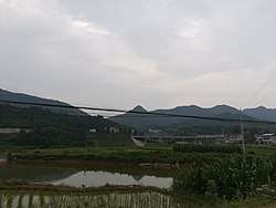 Fields and mountains in Shanshan Town. | |
 Shanshan Town Location in China | |
| Coordinates: 27°49′13″N 112°00′59″E / 27.82028°N 112.01639°ECoordinates: 27°49′13″N 112°00′59″E / 27.82028°N 112.01639°E | |
| Country | People's Republic of China |
| Province | Hunan |
| City | Loudi |
| District | Louxing District |
| Area | |
| • Total | 66.38 km2 (25.63 sq mi) |
| Population (2015) | 43,200 |
| Time zone | UTC+8 (China Standard) |
| Postal code | 417004 |
| Area code(s) | 0738 |
Shanshan Town (simplified Chinese: 杉山镇; traditional Chinese: 杉山鎮; pinyin: Shānshān Zhèn) is a rural town in Louxing District of Loudi City, Hunan Province, People's Republic of China. As of the 2015 census it had a population of 43,200 and an area of 66.38-square-kilometre (25.63 sq mi).[1]
History
In 2015, Xiaobi Township was merged into Shanshan Town.
Administrative division
The town is divided into 18 villages and 1 community, the following areas:
- Enkou Community (恩口社区)
- Shanshan Village (杉山村)
- Huaxi Village (花溪村)
- Tangping Village (塘坪村)
- Tianwan Village (田湾村)
- Jiyun Village (集云村)
- Yaozi Village (鹞子村)
- Lisong Village (栗松村)
- Wanle Village (万乐村)
- Mushan Village (木山村)
- Siji Village (四季村)
- Quanfu Village (泉福村)
- Tianping Village (田坪村)
- Batang Village (坝塘村)
- Ranpu Village (染铺村)
- Leshan Village (乐善村)
- Shidi Village (石底村)
- Shilong Village (石龙村)
- Shiyuan Village (石垣村)
Geography
The town shares a border with Shijing Town to the west, Fanjiang Town to the east, Hutian Town of Xiangxiang to the northeast, Shuangjiang Township to the northwest, and Lianbin Subdistrict to the south.[2]
Transportation
Provincial Highway
Provincial Highway S209 is a north-south highway in the town.[2]
Expressway
Changsha-Shaoshan-Loudi Expressway passes across the township east to west.[2]
Railway
The Luoyang–Zhanjiang Railway, from Luoyang City, Henan Province to Zhanjiang City, Guangdong Province, through the town.[2]