Changqing, Loudi
| Changqing Subdistrict | |
|---|---|
| Subdistrict | |
| Chinese transcription(s) | |
| • Simplified | 长青街道 |
| • Traditional | 長青街道 |
| • Pinyin | Chángqīng Jiēdào |
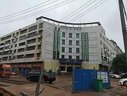 The Changqing Police Station. | |
 Changqing Subdistrict Location in Hunan. | |
| Coordinates: 27°43′44″N 111°59′25″E / 27.72889°N 111.99028°ECoordinates: 27°43′44″N 111°59′25″E / 27.72889°N 111.99028°E | |
| Country | People's Republic of China |
| Province | Hunan |
| City | Loudi |
| District | Louxing District |
| Area | |
| • Total | 5.5 km2 (2.1 sq mi) |
| Population (2015) | 70,000 |
| Time zone | UTC+8 (China Standard) |
| Postal code | 417000 |
| Area code(s) | 0738 |
Changqing Subdistrict (simplified Chinese: 长青街道; traditional Chinese: 長青街道; pinyin: Chángqīng Jiēdào) is a subdistrict in Louxing Districtof Loudi City, Hunan Province, People's Republic of China.
Administrative division
The subdistrict is divided into 9 communities, the following areas:
- Zhushan Community (竹山社区)
- Guanjia Community (关家社区)
- Gengtang Community (耕塘社区)
- Louxing Community (娄星社区)
- Xiaohua Community (小花社区)
- Dongxin Community (洞新社区)
- Changqing Community (长青社区)
- Fuqing Community (扶青社区)
- Ganzichong Community (甘子冲社区)
Geography
Lianshui River, also known as the mother river, flows through the subdistrict.[1]
Economy
The local economy is primarily based upon commerce and local industry.
Hospital
The Loudi Central Hospital is situated at the subdistrict. The Chinese Medicine Hospital of Loudi is also sits in the subdistrict.[1]
Education
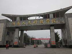
Hunan University of Humanities, Science and Technology is a state-owned provincial university in the subdistrict.[1]
Transportation
Railway
The Luoyang–Zhanjiang Railway, from Luoyang City, Henan Province to Zhanjiang City, Guangdong Province runs through the subdistrict.[1]
The Shanghai–Kunming railway, more commonly known as "Hukun railway", is a west-east railway passing through the subdistrict.[1]
Attractions
Three public parks are located in the town: Shima Park, Zhushan Park (株山公园) and Xiannüzhai Ecological Park (仙女寨生态公园).[1]