Huangnitang, Loudi
| Huangnitang Subdistrict | |
|---|---|
| Subdistrict | |
| Chinese transcription(s) | |
| • Simplified | 黄泥塘街道 |
| • Traditional | 黃泥塘街道 |
| • Pinyin | Huángnítáng Jiēdào |
 Xiaoxiang Vocational College. | |
 Huangnitang Subdistrict Location in Hunan. | |
| Coordinates: 27°45′36″N 111°59′10″E / 27.76000°N 111.98611°ECoordinates: 27°45′36″N 111°59′10″E / 27.76000°N 111.98611°E | |
| Country | People's Republic of China |
| Province | Hunan |
| City | Loudi |
| District | Louxing District |
| Area | |
| • Total | 18 km2 (7 sq mi) |
| Population (2015) | 74,000 |
| Time zone | UTC+8 (China Standard) |
| Postal code | 417000 |
| Area code(s) | 0738 |
Huangnitang Subdistrict (simplified Chinese: 黄泥塘街道; traditional Chinese: 黃泥塘街道; pinyin: Huángnítáng Jiēdào) is a subdistrict in Louxing District of Loudi City, Hunan Province, People's Republic of China.
Administrative division
The subdistrict is divided into 5 villages and 14 communities, the following areas:
- Xinli Community (新立社区)
- Fuling Community (福岭社区)
- Shuangyuan Community (双园社区)
- Shichang Community (市场社区)
- Fengyang Community (凤阳社区)
- Gaoxi Community (高溪社区)
- Hongjiazhou Community (洪家洲社区)
- Tanjiashan Community (谭家山社区)
- Suoqiao Community (索桥社区)
- Huamiaochong Community (花庙冲社区)
- Chaoyang Community (朝阳社区)
- Gongyuan Community (公园社区)
- Pangshanchong Community (旁山冲社区)
- Bixi Community (碧溪社区)
- Nanyang Village (南阳村)
- Enkou Village (恩口村)
- Donglai Village (东来村)
- Caojia Village (曹家村)
- Lianbin Village (涟滨村)
Geography
Lianshui River flows through the subdistrict.[1]
Economy
The economy is supported primarily by commerce and local industry.
Education
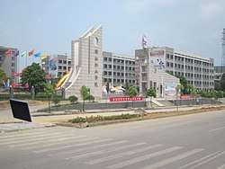
Xiaoxiang Vocational College (潇湘职业学院) is a vocational college sits in the subdistrict.[1]
Hospital
Loudi No. 1 Renmin Hospital is situated at the subdistrict.[1]
Transportation
Railway
Roads
The subdistrict is connected to three roads and streets: Loulian High-Grade Highway, Louxing North Street and Xinxing Road.[1]
Attractions
Greet Mountain Park (青山公园) is located within the subdistrict limits and has boating, walking and sporting events.[2]
References
- 1 2 3 4 5 Zhang Hong, ed. (2018). "Louxing District and Shuangfeng County" 《娄星区和双峰县》. 《中国分省系列地图册:湖南》 [Maps of Provinces in China: Hunan] (in Chinese). Xicheng District, Beijing: SinoMaps Press. pp. 170–171. ISBN 978-7-5031-8949-4.
- ↑ 娄底26个春游好去处,划船、赏花、放风筝、爬山、徒步……怎么嗨都随你!. qq.com (in Chinese). 2018-03-12.