Shahapur, Karnataka
| Shahapur Sagaranadu | |
|---|---|
| city | |
 Shahapur Location in Karnataka, India | |
| Coordinates: 16°42′N 76°50′E / 16.7°N 76.83°ECoordinates: 16°42′N 76°50′E / 16.7°N 76.83°E | |
| Country |
|
| State | Karnataka |
| District | Yadagiri |
| Lok Sabha Constituency | Raichur |
| Elevation | 428 m (1,404 ft) |
| Population (2011) | |
| • Total | 53,366 |
| Languages | |
| • Official | ಕನ್ನಡ |
| Time zone | UTC+5:30 (IST) |
| PIN | 585223 |
| Telephone code | 08479 |
| Vehicle registration | KA 33 |
| Website | www.shahapuracity.mrc.gov.in |
Shahapur is a city and taluka headquarter located in the Yadgir district of Indian state of Karnataka. Shahapur is 597 km north of Bangalore and well connected by road to Gulbarga (70 km), Hyderabad (210 km), Bidar (160 km) and Yadgir (32 km).
Geography
Shahapur is located at 16°42′N 76°50′E / 16.7°N 76.83°E.[1] It has an average elevation of 428 metres (1404 feet). when you search the karnataka physical map you will see in yadgir district map the hills mentioned by the name SHAHAPUR HILLS these hills spread along shahapur to surpur taluks.
Demographics
As per 2011 Indian census, Shahapur had a population of 57,129. Males constitute 52% of the population and females 48%. Shahapur has an average literacy rate of 52%, lower than the national average of 65.38% and also lower than the state literacy which is 67%: shahapur male literacy is 61%, and female literacy is 43%. In Shahapur, 16% of the population is under 6 years of age.
About
The Town Municipal Council (TMC) Shahapur was constituted in 1954.and this TMC is upgraded (in.2015)as a (CMC) (City Municipal Council). The CMC has 23 wards and equal number of councilors. Shahapura CMC stretches to an area of 13.65 km2. Summer Temperature as high as 45 -43 degree Celsius and Winter Temp-27 degree Celsius
Name
As per the mythology the old name of Shahapur was "Sagar". In support of this name there is historical evidence such as the sobriquet of the Vijayanagara Kingdom's last ruler Ramaraya (son in law of Srikrishna Devaraya), who was also called as "Sagara Sankramanaraya". After the Muslim attack the name of the city was changed to Nusratabad.As per historians after attack "Sagar "village is shifted to the other side of the hill line and the original Sagar has been abandoned for some time and it was called as "Halu Sagar". As time passes and now it is called as "Hali sagar" means Old Sagar. The area between Krishna and Bhima river is called "Sagara Nadu". It consists of Shahapur, Surpur (Shorapur) and Jewargi talukas.
Climate
| Climate data for Shahapura, India | |||||||||||||
|---|---|---|---|---|---|---|---|---|---|---|---|---|---|
| Month | Jan | Feb | Mar | Apr | May | Jun | Jul | Aug | Sep | Oct | Nov | Dec | Year |
| Average high °C (°F) | 30.6 (87.1) |
33.4 (92.1) |
36.6 (97.9) |
38.6 (101.5) |
39.4 (102.9) |
34.7 (94.5) |
31.5 (88.7) |
31.4 (88.5) |
31.3 (88.3) |
31.8 (89.2) |
30.4 (86.7) |
29.6 (85.3) |
33.3 (91.9) |
| Daily mean °C (°F) | 24 (75) |
26.5 (79.7) |
29.5 (85.1) |
31.9 (89.4) |
32.7 (90.9) |
29.2 (84.6) |
27.1 (80.8) |
26.9 (80.4) |
26.7 (80.1) |
26.8 (80.2) |
24.6 (76.3) |
23.2 (73.8) |
27.4 (81.4) |
| Average low °C (°F) | 17.5 (63.5) |
19.6 (67.3) |
22.5 (72.5) |
25.3 (77.5) |
26.0 (78.8) |
23.8 (74.8) |
22.8 (73) |
22.5 (72.5) |
22.2 (72) |
21.8 (71.2) |
18.9 (66) |
16.8 (62.2) |
21.6 (70.9) |
| Average rainfall mm (inches) | 0 (0) |
2 (0.08) |
8 (0.31) |
16 (0.63) |
29 (1.14) |
97 (3.82) |
161 (6.34) |
130 (5.12) |
185 (7.28) |
92 (3.62) |
16 (0.63) |
7 (0.28) |
743 (29.25) |
| Source: Climate-Data.org - Climate Table of Shahapura, Karnataka, India[2] | |||||||||||||
Attractions
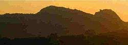
a) Sleeping Buddha Hill, made up of four hills looks like 'sleeping buddha' This is nature's gift and popular attraction of Shahapur.
b) Vishwa Maata Goshaale is a must visit place.
"In India, Vishwa Maata Goshaala stands at Second Place (2nd) for preserving, protecting, breeding the highest number of Indian Desi Cow breeds"
Located at the foothills of Charabasaveshwar temple in a small hillock called Nandi Betta.
The goshaale has 24 Indian Desi Cow breeds and
Goshaale has around 250 desi cows.
Shahapur is also famous for Temples and Fort.
Temples:-
1) Chara Basaveshwara temple
2) Siddalingeswara Temple
3) Diggi Sangameshwara temple (origin place of Siddeshwara temple of solapur maharastra)
4) Bheemarayan gudi (temple)(5 km)
5)Shri Ananthnath Bhagawan Jain Temple
6) World's Finest Urenium Ore Base at Gogi (10 km)
7)shahapur fort(built in950-1150ad)
8)Near Mandakini lake of fort, a Hanuman temple exists which was built by Shri Vyasaraaja which was later mutilated by Muslim rulers.Again it was re-installed recently by Shri Krupaanandaji Mahaaraj (Shri Ram Rao Mirji)
8)melgiri parvata(cave of lord mallikarjuna linga)
9)mouneshvara betta.
10)pandavra bande(pandavas lived few days here)
11)Sidhdhalingappana Betta. History tells that the great scholar Bhaskaracharya had lived for sometime while doing his spiritual sadhana.
12)Naga Basappa & Gavi Siddappa
13)Sharabhalingeshwara temple in Sagar al
14) Budhdha Vihaara
Shahapur is famous for Chara Basaveshwara Temple, which is surrounded by hills in all directions. Its annual function called "Jatre" is celebrated every year in April. Thousands of people gather for this special event. They believe that Charabasava will provide health, wealth and prosperity to whole family. The main attraction of this occasion is "bullock festival", thousands of bullocks from different parts of surrounding districts gather here for trade, which used to take place for nearly 10 days. By the side of Charabasava Temple A Large Fort is there. which had seven gates to enter. Within the fort 7 cannons are still present in good condition. As per the historians the construction period of this fort was between 950 AD to 1100 AD. Till the attack of Aurangazebs General Afzal Khan we don't know the pre history of this fort. Mandakini Lake is situated within the fort and the "Lotus Lake" or the "Tavare keri" Beside the Fort surrounded by hills.
According to mythology "Sagar Chakravarti" was grand father of "Bhagiratha" ()who brought river goddess Ganga to earth for cleaning his ancestor's sins. Mandakini was the result of Sagar king's tapasya. Thus the name Sagara Nadu.
The Bhoruka power company in the private sector to successfully commission a hydro power station in shahapur.
The houses of village "Bendegumbali" are considered to be the most well-constructed houses without the usage of modern tools (it has been officially stated by GOVT OF INDIA). Sannati is the Only place in the whole of India where complete unbroken inscription of emperor Ashoka was found.
Vishwamaata Goshaale is an aashram built to conserve the Indian cow breed, completely dedicated to Go seva without any profit . It is run by Sangameshwar Shankar Shaastri, a student of Vedanta, a teacher of Samskrut . It is run in a small hill called Nandi Betta, present at the footsteps of Charabasaveshwar Temple.
Taluka
The Shahpur Taluka contains thirty-six panchayat villages:[3]
- Anabi[4]
- Bendebembali
- Bilar
- Chamnal
- Chatnalli
- Doranhalli
- Gogikona
- Gogipeth
- Gonal
- Gulsaram
- Haiyyal.B.
- Halgera
- Hattigudur
- Hoskera
- Hotpet
- Ibrahimpur[5]
- Kadamgera
- Kakkasgera
- Kannekollur
- Khanapur
- Kollur
- Konkal
- Kurkunda
- Mudbool
- Maddarki
- Naganatagi
- Naikal
- Rastapur
- Sagar
- Sirval (Sirwal)
- T. Wadagera
- Hire Tumkur
- Tadabidi
- Ukkinal
- Ulle Sugoor
- Vadagera (Wadgera)
- Vanadurg (Wandurg)
katamanahalli 585304
References
- ↑ Falling Rain Genomics, Inc - Shahpur
- ↑ "Climate Table of Shahapura, Karnataka, India". Climate-Data.org. Retrieved 31 January 2015.
- ↑ "Reports of National Panchayat Directory: Village Panchayat Names of Shahapur, Yadgir, Karnataka". Ministry of Panchayati Raj, Government of India. Archived from the original on 27 February 2013.
- ↑ "Anabi Population - Yadgir, Karnataka". Office of the Registrar General & Census Commissioner, India. Archived from the original on 12 December 2016.
- ↑ "Ibrahimpur Population - Yadgir, Karnataka". Office of the Registrar General & Census Commissioner, India. Archived from the original on 12 December 2016.
Tadabidi
External links
- https://web.archive.org/web/20090827043023/http://shahapuratown.gov.in/
- http://ibnlive.in.com/news/karnataka-uranium-mining-in-gogi-cleared/182896-60-115.html
- http://www.bhorukapower.com/shahapur.htm
- http://www.hindu.com/2010/07/30/stories/2010073052480300.htm
District HQ: Yadgir | |||||||
| Cities and towns | |||||||
| Villages and other settlements |
| ||||||
| Parks, reserves and places of interest | |||||||