Seronera Airstrip
| Seronera Airstrip Uwanja mdogo wa Ndege wa Seronera | |||||||||||
|---|---|---|---|---|---|---|---|---|---|---|---|
 | |||||||||||
| Summary | |||||||||||
| Airport type | Public | ||||||||||
| Owner | Government of Tanzania | ||||||||||
| Operator | TANAPA | ||||||||||
| Serves | Seronera | ||||||||||
| Location | Serengeti National Park, Tanzania | ||||||||||
| Elevation AMSL | 5,080 ft / 1,548 m | ||||||||||
| Coordinates | 2°27′25″S 34°49′17″E / 2.45694°S 34.82139°ECoordinates: 2°27′25″S 34°49′17″E / 2.45694°S 34.82139°E | ||||||||||
| Website | Seronera Airport | ||||||||||
| Map | |||||||||||
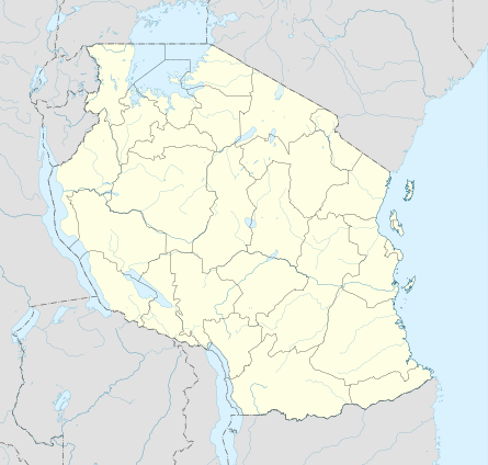 SEU Location of airstrip in Tanzania  SEU SEU (Africa) | |||||||||||
| Runways | |||||||||||
| |||||||||||
Seronera Airstrip (IATA: SEU, ICAO: HTSN) is the primary airstrip in the Serengeti National Park.
Airlines and destinations
| Airlines | Destinations |
|---|---|
| Air Excel | Arusha, Manyara[4] |
| Auric Air | Arusha, Grumeti, Klein's Camp, Kogatende, Lobo, Manyara, Sasakwa[5] |
| Coastal Aviation | Arusha, Dar es Salaam, Entebbe (via Tarime), Fort Ikoma, Grumeti, Kilimanjaro, Kogatende, Lobo, Pangani (Mashado), Manyara, Mwanza, Ndutu, Sasakwa, Selous (Lower), Selous (Upper), Ruaha, Tarime, Zanzibar[6] |
| Flightlink | Arusha, Dar es Salaam, Kilimanjaro, Zanzibar[7] |
| Regional Air | Arusha, Dar es Salaam, Grumeti, Kilimanjaro, Kogatende, Lobo, Manyara, Sasakwa, Zanzibar[8] |
| Safari Plus | Arusha, Zanzibar[9] |
Gallery
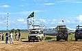 Parked aircraft
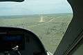 Runway
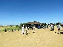
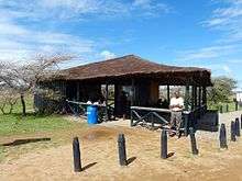 Terminal
See also


- List of airports in Tanzania
- Transport in Tanzania
References
- ↑ Airport information for SEU at Great Circle Mapper.
- ↑ Google Maps - Seronera
- ↑ "List of Aerodromes in Tanzania" (PDF). Tanzania Civil Aviation Authority. Retrieved 4 April 2013.
- ↑ "Flight Schedule" (PDF). Air Excel. 1 January 2012. Retrieved 27 January 2013.
- ↑ "Flight Schedule" (PDF). Auric Air. 16 December 2012. Retrieved 29 January 2013.
- ↑ "Flight Schedule" (PDF). Coastal Aviation. 16 December 2012. Archived from the original (PDF) on 16 June 2012. Retrieved 26 January 2013.
- ↑ "Flight Schedule" (PDF). Flightlink. 1 June 2012. Retrieved 28 January 2013.
- ↑ "Flight Schedule" (PDF). Regional Air. Retrieved 27 January 2013.
- ↑ "Flight Schedule". Safari Plus. Retrieved 29 January 2013.
External links
| Wikimedia Commons has media related to Seronera Airstrip. |
- Tanzania Airports Authority
- OurAirports - Seronera
- OpenStreetMap - Seronera
- Seronera Airstrip on YouTube
This article is issued from
Wikipedia.
The text is licensed under Creative Commons - Attribution - Sharealike.
Additional terms may apply for the media files.