Seleute
| Seleute | ||
|---|---|---|
| Former municipality of Switzerland | ||
| ||
 Seleute | ||
|
Location of Seleute 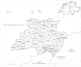 Seleute Seleute (Canton of Jura) | ||
| Coordinates: 47°22′N 07°07′E / 47.367°N 7.117°ECoordinates: 47°22′N 07°07′E / 47.367°N 7.117°E | ||
| Country | Switzerland | |
| Canton | Jura | |
| District | Porrentruy | |
| Area | ||
| • Total | 6.81 km2 (2.63 sq mi) | |
| Elevation | 650 m (2,130 ft) | |
| Population | ||
| • Total | 75 | |
| • Density | 11/km2 (29/sq mi) | |
| Postal code | 2888 | |
| SFOS number | 6805 | |
| Surrounded by | Saint-Ursanne, Montmelon, Epauvillers, Epiquerez, Ocourt , Courgenay | |
| Website |
SFSO statistics | |

Seleute is a village and former municipality in the district of Porrentruy in the canton of Jura in Switzerland. Since January 1, 2009 it has been part of the municipality of Clos du Doubs.[1]
References
| Wikimedia Commons has media related to Seleute. |
- ↑ "Seleute official Facebook". Facebook.
This article is issued from
Wikipedia.
The text is licensed under Creative Commons - Attribution - Sharealike.
Additional terms may apply for the media files.