Seifhennersdorf
| Seifhennersdorf | ||
|---|---|---|
.jpg) | ||
| ||
 Seifhennersdorf Location of Seifhennersdorf within Görlitz district 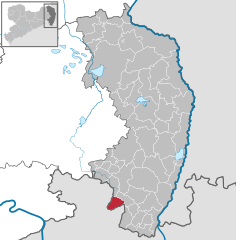  | ||
| Coordinates: 50°56′N 14°37′E / 50.933°N 14.617°ECoordinates: 50°56′N 14°37′E / 50.933°N 14.617°E | ||
| Country | Germany | |
| State | Saxony | |
| District | Görlitz | |
| Government | ||
| • Mayor | Karin Berndt (UBS) | |
| Area | ||
| • Total | 19.13 km2 (7.39 sq mi) | |
| Elevation | 360 m (1,180 ft) | |
| Population (2017-12-31)[1] | ||
| • Total | 3,707 | |
| • Density | 190/km2 (500/sq mi) | |
| Time zone | CET/CEST (UTC+1/+2) | |
| Postal codes | 02782 | |
| Dialling codes | 03586 | |
| Vehicle registration | GR | |
| Website | www.seifhennersdorf.de | |

Seifhennersdorf (Upper Sorbian: Wodowe Hendrichecy) is a town in the district Görlitz, in the Free State of Saxony, Germany. It is situated on the border with the Czech Republic, and the Czech towns of Rumburk and Varnsdorf lie across the border to the north-east and south of town.
Seifhennersdorf is 8 km south of Ebersbach and 14 km west of Zittau.
History
During World War II, a subcamp of Flossenbürg concentration camp was located in the town.[2]
References
- ↑ "Aktuelle Einwohnerzahlen nach Gemeinden 2017] (Einwohnerzahlen auf Grundlage des Zensus 2011)" (PDF). Statistisches Landesamt des Freistaates Sachsen (in German). October 2018.
- ↑ Christine O'Keefe. Concentration Camps
This article is issued from
Wikipedia.
The text is licensed under Creative Commons - Attribution - Sharealike.
Additional terms may apply for the media files.