Seguin, Kansas
| Seguin | |
|---|---|
| Unincorporated community | |
 Seguin Location within the state of Kansas  Seguin Seguin (the US) | |
| Coordinates: 39°20′15″N 100°35′42″W / 39.33750°N 100.59500°WCoordinates: 39°20′15″N 100°35′42″W / 39.33750°N 100.59500°W | |
| Country | United States |
| State | Kansas |
| County | Sheridan |
| Elevation | 2,858 ft (871 m) |
| Time zone | UTC-6 (Central (CST)) |
| • Summer (DST) | UTC-5 (CDT) |
| GNIS feature ID | 471269[1] |
Seguin is an unincorporated community in Sheridan County, Kansas, in the United States, located in Logan Township about 10 miles west of the county seat in Hoxie. It lies south of U.S. Route 24, to which it is linked by Kansas Highway 188.[2]
History
A post office was opened in Seguin in 1889, and remained in operation until it was discontinued in 1943.[3] In 1910, the population was 11.[4] The community was primarily settled by German Catholics.[5][6][7]
The 99-mile Plainville-Colby branch of the Union Pacific Railroad which passed through Seguin and dated from the late 1880s, was abandoned in 1998.[8][9]
References
- ↑ "Seguin". Geographic Names Information System. United States Geological Survey.
- ↑ "Sheridan County". Blue Skyways. Kansas State Library. Retrieved 23 June 2014.
- ↑ "Kansas Post Offices, 1828-1961". Kansas Historical Society. Archived from the original on October 9, 2013. Retrieved 23 June 2014.
- ↑ Kansas: A Cyclopedia of State History, p. 665 (1912)
- ↑ Schlageck John (4 January 2016). Two-room school, Hays Daily News
- ↑ Schlageck, John (1 October 2011). Doodlebug and Jitney, Emporia Gazette
- ↑ History of our Churches, Hoxieseguinparishes.org, Retrieved 23 October 2017
- ↑ Surfact Transportation Board Decision, Docket No. AB-33, March 21, 1997, STB.gov, Retrieved 23 October 2017
- ↑ The Plainville Branch, Abandonedrails.com, Retrieved 23 October 2017
External links
- Aftermath of 1925 Tornado in Seguin, Kansasmemory.org
- Sheridan County Maps: Current, Historic, KDOT
Municipalities and communities of Sheridan County, Kansas, United States | ||
|---|---|---|
| Cities | 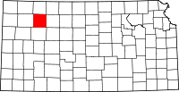 | |
| Unincorporated communities | ||
| Ghost towns | ||
| Townships | ||
This article is issued from
Wikipedia.
The text is licensed under Creative Commons - Attribution - Sharealike.
Additional terms may apply for the media files.