Schieren
| Schieren Schieren | ||
|---|---|---|
| Commune | ||
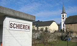 Schieren train station and church | ||
| ||
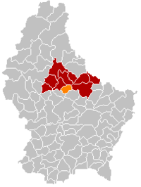 Map of Luxembourg with Schieren highlighted in orange, and the canton in dark red | ||
| Coordinates: 49°50′00″N 6°06′00″E / 49.8333°N 6.1°ECoordinates: 49°50′00″N 6°06′00″E / 49.8333°N 6.1°E | ||
| Country |
| |
| Canton | Diekirch | |
| Government | ||
| • Mayor | André Schmit | |
| Area | ||
| • Total | 10.41 km2 (4.02 sq mi) | |
| Area rank | 97 of 102 | |
| Highest elevation | 515 m (1,690 ft) | |
| • Rank | 15th of 102 | |
| Lowest elevation | 198 m (650 ft) | |
| • Rank | 25th of 102 | |
| Population (2014) | ||
| • Total | 1,769 | |
| • Rank | 76th of 102 | |
| • Density | 170/km2 (440/sq mi) | |
| • Density rank | 43rd of 102 | |
| Time zone | UTC+1 (CET) | |
| • Summer (DST) | UTC+2 (CEST) | |
| LAU 2 | LU00002013 | |
| Website | schieren.lu | |

Schieren is a commune and town in central Luxembourg. It is part of the canton of Diekirch, which is part of the district of Diekirch.
As of 2001, the town of Schieren itself, which lies in the west of the commune, has a population of 1,358. It is located on the rail line to Ettelbruck.
Schieren was formed on 1 July 1850, when it was detached from the commune of Ettelbruck, along with the commune of Erpeldange. The law forming Schieren was passed on 22 January 1850.[1]
In 1894, Schieren established a fire station with five volunteer firefighters. It has a notable church.
Footnotes
- ↑ (in French)/(in German) "Mémorial A, 1850, No. 18" (PDF). Service central de législation. Retrieved 2006-08-15.
External links

- (in French) Commune of Schieren official website
- (in German) Unofficial website on local activities
Places adjacent to Schieren | ||||||||||
|---|---|---|---|---|---|---|---|---|---|---|
| ||||||||||
 | ||
This article is issued from
Wikipedia.
The text is licensed under Creative Commons - Attribution - Sharealike.
Additional terms may apply for the media files.