Reisdorf
| Reisdorf Reisduerf | ||
|---|---|---|
| Commune | ||
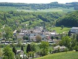 Reisdorf seen from the north | ||
| ||
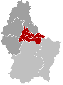
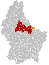 Map of Luxembourg with Reisdorf highlighted in orange, and the canton in dark red | ||
| Coordinates: 49°52′00″N 6°16′00″E / 49.8667°N 6.2667°ECoordinates: 49°52′00″N 6°16′00″E / 49.8667°N 6.2667°E | ||
| Country |
| |
| Canton | Diekirch | |
| Government | ||
| • Mayor | Fränk Weber | |
| Area | ||
| • Total | 14.84 km2 (5.73 sq mi) | |
| Area rank | 83rd of 102 | |
| Highest elevation | 406 m (1,332 ft) | |
| • Rank | 44th of 102 | |
| Lowest elevation | 175 m (574 ft) | |
| • Rank | 16th of 102 | |
| Population (2014) | ||
| • Total | 1,132 | |
| • Rank | 94th of 102 | |
| • Density | 76/km2 (200/sq mi) | |
| • Density rank | 73rd of 102 | |
| Time zone | UTC+1 (CET) | |
| • Summer (DST) | UTC+2 (CEST) | |
| LAU 2 | LU00002012 | |
| Website | reisdorf.lu | |

Reisdorf (Luxembourgish: Reisduerf) is a commune and small town in eastern Luxembourg, on the river Sauer. It is part of the canton of Diekirch, which is part of the district of Diekirch.
In 2005, Reisdorf, which lies in the centre of the commune, had a population of 479. Other towns within the commune include Hoesdorf.
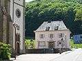 Reisdorf town hall
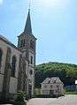 Reisdorf town hall and church
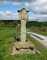 Wayside cross at the N10, just outside the town
External links

Places adjacent to Reisdorf | ||||||||||
|---|---|---|---|---|---|---|---|---|---|---|
| ||||||||||
 | ||
This article is issued from
Wikipedia.
The text is licensed under Creative Commons - Attribution - Sharealike.
Additional terms may apply for the media files.