Satsumasendai, Kagoshima
| Satsumasendai 薩摩川内市 | |||
|---|---|---|---|
| City | |||
 | |||
| |||
|
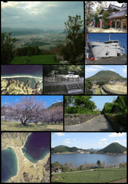
Location of Satsumasendai in Kagoshima Prefecture | |||
 Satsumasendai Location in Japan | |||
| Coordinates: 31°49′N 130°18′E / 31.817°N 130.300°ECoordinates: 31°49′N 130°18′E / 31.817°N 130.300°E | |||
| Country | Japan | ||
| Region | Kyushu | ||
| Prefecture | Kagoshima Prefecture | ||
| Government | |||
| • Mayor | Hideo Iwakiri | ||
| Area | |||
| • Total | 683.50 km2 (263.90 sq mi) | ||
| Population (May 1, 2017) | |||
| • Total | 96,411 | ||
| • Density | 140/km2 (370/sq mi) | ||
| Symbols | |||
| • Tree | Round leaf holly (Ilex rotunda) | ||
| • Flower | Lilium speciosum | ||
| • Bird | Japanese white-eye | ||
| • Fish |
Stream: Ayu Oceanic: Slender sprat | ||
| Time zone | UTC+9 (JST) | ||
| City hall address |
3-22, Kandachō, Satsumasendai-shi, Kagoshima-ken 895-8650 | ||
| Website |
www | ||
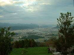
Satsumasendai (薩摩川内市 Satsumasendai-shi) is a city located in Kagoshima Prefecture, Japan.
The modern city of Satsumasendai was established on October 12, 2004, from the merger of the city of Sendai, the towns of Hiwaki, Iriki, Kedōin and Tōgō, and the Koshikijima Islands (which consisted of the villages of Kamikoshiki, Kashima, Sato and Shimokoshiki, all from Satsuma District).
As of May 2017, the city has an estimated population of 96,411 and a population density of 140 persons per km2.[1] The total area is 683.50 km2.
The city has regular Shinkansen services to Kagoshima City and Yatsushiro.
The city is also home to Kagoshima Immaculate Heart University, founded in 1994, which has a small population of foreign students.
A major employer is the Sendai nuclear power station.
Timeline
From 1889 to 2004
- April 1, 1889 - municipal status enforcement.
- Satsuma District : the villages of Kumanojō, Takae, Nagatoshi, Hirasa, Kami-Tōgō, Shimo-Tōgō, Hiwaki and Iriki.
- Taki District : the villages of Taki and Mizuhiki.
- Minami-Isa District : the villages of Ōmura, Kuroki and Imuta.
- Koshikijima District : the villages of Kami-Koshiki Shimo-Koshiki.
- March 29, 1896 - The districts of Taki, Minami-Isa and Koshikijima were merged into Satsuma District.
- May 20, 1929 - The villages of Kumanojō, Hirasa and Higashi-Mizuhiki were merged to become town of Sendai.
- July 1, 1933 - The village of Nishimizuhiki was renamed to Mizuhiki.
- February 11, 1940 - the town of Sendai was elevated city status to become the city of Sendai.
- November 10, 1940 - The village of Hiwaki was elevated to town status to become the town of Hiwaki.
- October 1, 1948 - The village of Iriki was elevated to town status to become the town of Iriki.
- April 1, 1951 - The village of Mizuhiki was merged into the city of Sendai.
- December 1, 1952 - The village of Kami-Tōgō was elevated to town status to become the town of Tōgō.
- April 1, 1955 - The villages of Ōmura, Kuroki and Imuta were merged to become the town of Kedōin.
- September 30, 1956 - The villages of Takae and Nagatoshi were merged into the city of Sendai.
- April 1, 1957
- Part of Shimo-Tōgō was merged into the town of Tōgō and the village of Taki (respectively).
- Remainder of Shimo-Tōgō was merged into the city of Sendai.
- January 1, 1960 - The village of Taki was elevated to town status to become the town of Taki.
- April 15, 1965 - The town of Taki was merged into city of Sendai.
Satsumasendai (After 2004)
- October 12, 2004 - the city of Satsumasendai was created from the merger of the city of Sendai, Kagoshima, the towns of Hiwaki, Iriki, Kedōin and Tōgō, and the Koshikijima Islands (which consisted of the villages of Kamikoshiki, Kashima, Sato and Shimokoshiki) (all from Satsuma District).
Festivals
- Sendai Otsunahiki
- Sendai River Fireworks Festival
Neighboring municipalities
Friendship cities

Transport
Railways
- Kyushu Railway Company
- Kyushu Shinkansen
- Kagoshima Main Line
- Sendai Station - Kumanojo Station - Kobanchaya Station
- Hisatsu Orange Railway
- Hisatsu Orange Railway Line
- Nishikata Station - Satsuma-Taki Station - Kusamichi Station - Kamisendai Station - Sendai Station
- Hisatsu Orange Railway Line
- Former railway line
- Japan National Railway
- Miyanojo Line(1924-1987)
- Sendai Station - Satsuma-Shirahama Station - Kusumoto Station - Yoshinoyama Station - Hiwaki Station - Kamihiwaki Station - Iriki Station
- Miyanojo Line(1924-1987)
Roads
- Highways
- Minamikyushu Expressway
- Satsumasendai-Miyako IC
- National Highway
References
- ↑ "Official website of Satsumasendai City" (in Japanese). Japan: Satsumasendai City. Retrieved 7 May 2017.
- ↑ 友好都市 - Satsumasendai City
External links
| Wikimedia Commons has media related to Satsumasendai, Kagoshima. |
- Satsumasendai City official website (in Japanese)
- Kagoshima Prefectural Visitors Bureau official website (in English)
- Sendai Giant Tug-of-war The Asahi Shimbun, 2012/09/23
| Core city | |||||||||||
|---|---|---|---|---|---|---|---|---|---|---|---|
| Cities |
| ||||||||||
| Districts |
| ||||||||||
| Authority control |
|---|