Santa Rosa de Copán
| Santa Rosa de Copán | |
|---|---|
 Cathedral of Saint Rose of Copan | |
 Santa Rosa de Copán Location in Honduras | |
| Coordinates: 14°46′N 88°47′W / 14.767°N 88.783°W | |
| Country | Honduras |
| Department | Copán |
| Established as city | 12 April 1843 |
| Population | |
| • Total | 42,803 |
| Climate | Cwa |
Santa Rosa de Copán (Spanish pronunciation: [ˈsanta ˈrosa ðe koˈpan]) is the departmental capital of the Honduran department of Copán. It is approximately 1,150 metres (3,773 ft) above mean sea level.
Santa Rosa de Copán, Honduras, is the largest and most important city in western Honduras with a population of 42,803. Santa Rosa is the governmental hub of the department of Copán. The city is connected through the International Highway of the West (CA-4) with San Pedro Sula to the North and with the borders of El Salvador at El Poy and Guatemala at Agua Caliente to the west. Santa Rosa has a subtropical climate with temperatures ranging from 25 °C (77 °F) to 29 °C (84 °F) in the summer (March–June), and from 13 °C (55 °F) to 15 °C (59 °F) in the winter (December–February).
The historical centre of Santa Rosa de Copán has been declared a Honduran national monument, with preservation of its Republican or Neoclassical architecture and cobblestone streets that has its origins in a prosperous tobacco farming industry of the 18th century. Santa Rosa is situated at a strategic point between Copán Ruinas and Gracias, Lempira and the Celaque National Park. As before, tobacco farming remains a staple of the local economy, particularly the cultivation of premium cigar tobaccos. The La Flor de Copán cigar factory is located in the city.
History
The town was founded in the early 18th century. On 8 August 1705, the Spanish colonial captain Don Juan García de la Candelaria acquired the area then called "Los Llanos" from the Spanish crown and founded his estate with four ranches, later the first settlers named it Santa Rosa, and later Santa Rosa de Los Llanos. A tobacco industry developed in the early 18th Century and in 1765 the town was picked as the site for La Real Factoria del Tabacos, the Royal Tobacco Company, a Spanish crown company. Later, the Gracias a Dios Department was split in two departments, becoming Copán department and Lempira department.
The town was on various occasions the capital of the State of Honduras. On 7 May 1862 the nation's President Don Victoriano Castellanos Cortes, issued Legislative Decree No. 3, giving the country the title of "Republic of Honduras" instead of "State of Honduras." In 1865, the town was renamed Santa Rosa de Copán.
Its Catedral de Santa Rosa, dedicated to Saint Rosa, is the cathedral episcopal see of the Roman Catholic Diocese of Santa Rosa de Copán (established on 1916.02.02).
Climate
Santa Rosa has a humid subtropical climate (Cwa) under the Köppen climate classification.
| Climate data for Santa Rosa, Honduras | |||||||||||||
|---|---|---|---|---|---|---|---|---|---|---|---|---|---|
| Month | Jan | Feb | Mar | Apr | May | Jun | Jul | Aug | Sep | Oct | Nov | Dec | Year |
| Record high °C (°F) | 27.6 (81.7) |
29.7 (85.5) |
32.1 (89.8) |
32.3 (90.1) |
31.8 (89.2) |
29.3 (84.7) |
27.3 (81.1) |
27.6 (81.7) |
28.2 (82.8) |
27.3 (81.1) |
27.3 (81.1) |
26.9 (80.4) |
32.3 (90.1) |
| Average high °C (°F) | 22.1 (71.8) |
23.9 (75) |
26.5 (79.7) |
28.1 (82.6) |
28.1 (82.6) |
26.6 (79.9) |
25.5 (77.9) |
25.8 (78.4) |
25.7 (78.3) |
24.1 (75.4) |
22.7 (72.9) |
21.9 (71.4) |
25.1 (77.2) |
| Daily mean °C (°F) | 17.6 (63.7) |
18.4 (65.1) |
20.4 (68.7) |
21.5 (70.7) |
21.9 (71.4) |
21.5 (70.7) |
21.0 (69.8) |
21.2 (70.2) |
21.0 (69.8) |
19.9 (67.8) |
18.7 (65.7) |
17.9 (64.2) |
20.1 (68.2) |
| Average low °C (°F) | 13.3 (55.9) |
12.9 (55.2) |
13.8 (56.8) |
15.0 (59) |
16.2 (61.2) |
17.4 (63.3) |
17.0 (62.6) |
17.1 (62.8) |
17.2 (63) |
16.4 (61.5) |
15.0 (59) |
13.9 (57) |
15.4 (59.7) |
| Record low °C (°F) | 8.0 (46.4) |
7.9 (46.2) |
8.8 (47.8) |
9.9 (49.8) |
11.2 (52.2) |
14.8 (58.6) |
14.5 (58.1) |
14.5 (58.1) |
14.5 (58.1) |
12.3 (54.1) |
10.1 (50.2) |
8.6 (47.5) |
7.9 (46.2) |
| Average precipitation mm (inches) | 39.9 (1.571) |
29.2 (1.15) |
24.1 (0.949) |
43.6 (1.717) |
153.5 (6.043) |
288.4 (11.354) |
210.7 (8.295) |
215.8 (8.496) |
295.6 (11.638) |
145.1 (5.713) |
76.3 (3.004) |
58.4 (2.299) |
1,580.6 (62.228) |
| Average precipitation days (≥ 1.0 mm) | 6 | 5 | 3 | 4 | 9 | 16 | 15 | 15 | 16 | 12 | 9 | 8 | 118 |
| Source: NOAA[1] | |||||||||||||
Sports
Football club Deportes Savio has been playing in the Honduran National league since 2007 and play their home matches at the Estadio Sergio Antonio Reyes.
Economy
Poor social and economic conditions plague a large share of Hondurans: In 2013, 64.5% of Hondurans were living in poverty, according to the World Bank. That's mostly unchanged since 2004. It's also higher than the national poverty rates in El Salvador (34.5% in 2012), Guatemala (53.7% in 2011) and Mexico (52.3% in 2012). In 2013, economic growth decelerated in Honduras to 2.6%, from 4% in 2012, according to the latest IMF assessment.
The Honduran economy is heavily dependent on money sent home from migrants: In 2012, 15.7% of Honduras’s GDP ($3 billion) came from remittances — the vast majority of which were US-based, according to Pew Research analysis of World Bank data.
References
- ↑ "Santa Rosa C. Climate Normals 1961–1990". National Oceanic and Atmospheric Administration. Retrieved 24 January 2016.
External links
Bibliography
- Urquía Fuentes, José Leonardo. History de Santa Rosa de Copán, "Los Llanos", (chronological historical essay) 2010.
Coordinates: 14°46′N 88°47′W / 14.767°N 88.783°W
Capital: Santa Rosa de Copán | ||
| Municipalities | 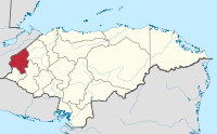 | |