Santa Rita, Copán
| Santa Rita | |
|---|---|
 Santa Rita Location in Honduras | |
| Coordinates: 14°52′N 89°6′W / 14.867°N 89.100°W | |
| Country | Honduras |
| Department | Copán |
| Area | |
| • Total | 292 km2 (113 sq mi) |
| Population (2015) | |
| • Total | 30,683 |
| • Density | 110/km2 (270/sq mi) |
Santa Rita is a municipality in the Honduran department of Copán.
History
The municipality of Santa Rita is believed to have been founded in 1700, where it was then known as Aldea Cashapa. However, the area was not recognized as a municipality until 1875.[1]
Villages
A total of 31 villages are in Santa Rita:[2]
- Santa Rita, which is head of the municipality
- Agua Caliente
- Buena Vista
- Campamento
- El Gobiado
- El Jaral
- El Mirador
- El Planón
- El Raizal
- El Rosario
- El Tamarindo
- Gotas de Sangre
- La Canteada
- La Casita
- La Libertad
- La Reforma
- La Unión Otuta
- Las Medias
- Las Mesas
- Los Achiotes
- Los Planes de La Brea
- Los Ranchos
- Minas de Piedras
- Mirasol
- Plan Grande
- Rastrojitos
- Río Amarillo
- Río Blanco
- San Jerónimo
- Tierra Fría No.1
- Tierra Fría No.2
- Vara de Cohete
References
Capital: Santa Rosa de Copán | ||
| Municipalities | 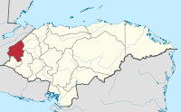 | |
This article is issued from
Wikipedia.
The text is licensed under Creative Commons - Attribution - Sharealike.
Additional terms may apply for the media files.