Dolores, Copán
| Dolores | |
|---|---|
 Dolores | |
| Coordinates: 14°52′0″N 88°50′0″W / 14.86667°N 88.83333°WCoordinates: 14°52′0″N 88°50′0″W / 14.86667°N 88.83333°W | |
| Country |
|
| Departament | Copán. |
| Area | |
| • Total | 47 km2 (18 sq mi) |
| Population (2015) | |
| • Total | 6,652 |
| • Density | 140/km2 (370/sq mi) |
Dolores is a municipality in the Honduran department of Copán.[1]
History
The area of Dolores in 1887 was heavily populated, which resembled Santa Rosa de Copan at the time. However, Dolores was not recognized as a municipality until January 1,1920. Dulce Nombre, another municipality in Copán, was created in 1907. Dolores formed as a member of this municipality on April 11,1919 where it stayed until becoming its own municipality.[2]
Villages
Dolores, Copán is home to the following villages:
- Agua Buena
- Dolores; which is the head of the municipality
- El Balsamo or La Canteada
- El Camalote
- Joyas Galanas
- Pasquingal
- Plan del Naranjo
- San Antonio
- Vega Redonda or San Antonio Flores
- Yaruconte
References
- ↑ Fiallos, Carmen. 1989. "Los Municipios de Honduras".
- ↑ Heriberta Laboriel de Meléndez, Hilcia González F. Monografía del Departamento de Copán, Ministerio de Educación Pública, Departamento de Recursos de Aprendizaje, Sección de "Producción de Materiales Educativos", Tegucigalpa, Honduras. (página 179)
Capital: Santa Rosa de Copán | ||
| Municipalities | 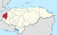 | |
Dolores is a pretty town in the mountains (1300 meters) They have an active city government, several churches, a federal police station. There are several small shops which sell cokes etc. they also have an internet cafe There are many pictures on the internet at https://web.archive.org/web/20090106104603/http://www.rader.org/dolores/dolores.htm