Santa Fe, Romblon
| Santa Fe Bayan ng Santa Fe | ||
|---|---|---|
| Municipality | ||
| Municipality of Santa Fe | ||
| ||
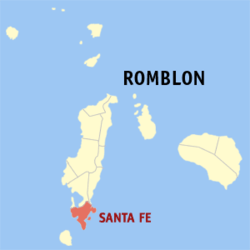 Map of Romblon with Santa Fe highlighted | ||
.svg.png) Santa Fe Location within the Philippines | ||
| Coordinates: 12°09′N 122°00′E / 12.15°N 122°ECoordinates: 12°09′N 122°00′E / 12.15°N 122°E | ||
| Country |
| |
| Region | Mimaropa (Region IV-B) | |
| Province | Romblon | |
| District | Lone district | |
| Founded | 1946 | |
| Barangays | 11 (see Barangays) | |
| Government [1] | ||
| • Type | Sangguniang Bayan | |
| • Mayor | Elsie Visca [2] | |
| • Vice Mayor | Miguel M. Galido [3] | |
| • Councilors[4] |
Dadoy Cawaling (UNA) Edmundo Malacad Blas Cruz W. Melwin Punzalan Maria Imelda Mayor y Fedelicio Fernando Fernando Melsie Coching Edgardo Bartolome | |
| Area [5] | ||
| • Total | 63.52 km2 (24.53 sq mi) | |
| Population (2015 census)[6] | ||
| • Total | 16,098 | |
| • Density | 250/km2 (660/sq mi) | |
| Time zone | UTC+8 (PST) | |
| ZIP code | 5510 | |
| PSGC | 175915000 | |
| IDD : area code | +63 (0)42 | |
| Climate type | Tropical climate | |
| Income class | 5th municipal income class | |
| Revenue (₱) | 56,745,911.05 (2016) | |
| Native languages |
Onhan language Tagalog | |

Santa Fe, officially the Municipality of Santa Fe, is a 5th class municipality in the province of Romblon, Philippines. According to the 2015 census, it has a population of 16,098 people.[6]
History
Legend says that the barrio was named after a beautiful, lovely daughter of one of its early settlers of the place. She was so loved and revered by the locals that they named her Santa Fe, and in her death, they named the place after her.[7] However, in Relacion de las Yslas Filipinas by Spanish conquistador Miguel de Loarca, it states that the barrio was named after Santa Fe in the province of Granada in Spain. Its first settlers were Onhan-speaking Negritos from Panay Island who emigrated to Tablas as early as 1730.[8][9]
During the Spanish colonial period, Santa Fe was a barrio of neighboring Looc town until 1855 when it was established as a separate pueblo or town. It was abolished and reverted into a barrio again in 1868. In 1892, the Spaniards restored Santa Fe's municipal status, which would remain until the American colonial period.[9]
Santa Fe was one 11 municipalities created in Romblon when civilian government was established in the province. However, on 10 March 1917, it was abolished and reverted once more into a barrio of Looc. On 8 January 1940, by virtue of Commonwealth Act No. 581, authored by Romblon congressman Leonardo Festin, the municipality of Looc was abolished and incorporated into a new special municipality called Tablas. Hence, Santa Fe became a barrio of this special municipality.[8][9]
On 1 October 1946, by virtue of Republic Act No. 38 authored by Romblon congressman Modesto Formilleza, the special municipality of Tablas was abolished and Looc municipality was reinstated. The law also created Santa Fe into an independent municipality.[10]
Santa Fe is also the home of Pinoy Big Brother Season 1 Big Winner Nene Tamayo.
Geography
Santa Fe has a total land area of 63.52 km2. It lies on the southern tip of Tablas Island. The town is mountainous with so many beaches and islets. It has sandy loam type of soil rich with mineral resources such as granite and white clay. The tallest elevation in the town is Mount Calatong.
Barangays
Santa Fe is politically subdivided into 11 barangays.
- Agmanic
- Canyayo
- Danao Norte
- Danao Sur
- Guinbirayan
- Guintigbasan
- Magsaysay
- Mat-i
- Pandan
- Poblacion
- Tabugon
Demographics
| Population census of Santa Fe | ||
|---|---|---|
| Year | Pop. | ±% p.a. |
| 1903 | 3,746 | — |
| 1948 | 8,168 | +1.75% |
| 1960 | 8,987 | +0.80% |
| 1970 | 8,032 | −1.12% |
| 1975 | 8,939 | +2.17% |
| 1980 | 9,948 | +2.16% |
| 1990 | 11,628 | +1.57% |
| 1995 | 12,665 | +1.61% |
| 2000 | 14,140 | +2.39% |
| 2007 | 16,315 | +1.99% |
| 2010 | 15,700 | −1.39% |
| 2015 | 16,098 | +0.48% |
| Source: Philippine Statistics Authority[6][11][12][13] | ||
At the 2015 census, Santa Fe had a population of 16,098 people. Most of its natives descended from Ati indigenous people from Panay Island. Majority of its population speak the Loocnon variant of Inunhan that switches /r/ or /l/ for /d/.
The townsfolk are predominantly Roman Catholic. Every April, they celebrate the "Fiesta sa Dagat", also known as "Fisherfolk's Day" in honor of St. Vincent Ferrer, the town's patron saint. Other Christian denominations include the Philippine Independent Church, Foursquare Gospel Church in the Philippines, Assemblies of God, Baptist Church, Jehovah's Witnesses, Seventh-day Adventist Church, and the Potter's Fellowship.
Local government
Pursuant to Chapter II, Title II, Book III of Republic Act 7160 or the Local Government Code of 1991,[14] the municipal government is composed of a mayor (alkalde), a vice mayor (bise alkalde) and members (kagawad) of the legislative branch Sangguniang Bayan alongside a secretary to the said legislature, all of which are elected to a three-year term and are eligible to run for three consecutive terms.
| Period | Mayor | Vice Mayor |
|---|---|---|
Santa Fe's incumbent mayor and vice mayor are Elsie Visca and Miguel M. Galido, both from the Liberal Party (Philippines)|Liberal Party]], respectively.[20]
Economy
Agriculture is the most important sector in the municipality. This sector comprises sub-sectors namely: crops, livestock, poultry, and fishing. Crops like rice, corn, mango, cassava, banana, sweet yam and coconut are raised by farmers. Coconut comprises the largest share of the agricultural area of the municipality and is dominantly grown in all barangays.[8]
Infrastructure
National Power Corporation (NPC) supplies 32.37% (or 836 households) of Santa Fe's households with electricity. The town is serviced by Levels 1, 2 and 3 water supply system. It also has four community irrigation projects with 92 service areas. Potable water is also supplied from water pumps, artesian wells, and rainwater collection reservoirs. PLDT, Smart Communications, and Globe Telecom provides landline and cellular phone service in the municipality. Radio, as well as, terrestrial and cable television services are also available.[8]
Santa Fe Municipal Port caters to intra-provincial travel, particularly between San Jose in Carabao Island. The town is connected to the neighboring towns of Looc and Alcantara through the Tablas Circumferential Road. Jeepneys, tricycles, and motorcycles are to common forms of transportation.[8]
Tourism
There are several beaches and other scenic spots to visit in Santa Fe. These include:[8]
- Mateo Beach Resort: Situated along a rough and winding road at Sitio Guinpoingan in Barangay Tabugon, only 5 kilometers away from the Poblacion. The place has stretches of white sand and clear blue waters.
- Santa Fe Trail This mountainous zigzag road leading to Santa Fe offers views of Tablas Strait, Looc Bay, the neighboring island of Panay, San Jose, and Boracay Island. A common place for strolling and sightseeing.
- Canyayo Beach It is located in Barangay Canyayo, some 4 kilometers from the Poblacion. This beach is a combination of white sands and crushed corals. Its ocean floor is of pebbles and drops abruptly.
- Japar Islet Located off coast of Barangay Guinbirayan. It is a small islet dotted with golden-hued sandy beaches. The sea here is generally calm the whole year and considered the richest ground in the province.
- Tablas Point Beach Resort Located at Agnamic, Sante Fe, Tablas Island Romblon, Philippines.
References
- ↑ "Municipality". Quezon City, Philippines: Department of the Interior and Local Government. Retrieved 31 May 2013.
- ↑ http://www.gmanetwork.com/news/eleksyon2016/results/local/REGION+IV-B/ROMBLON/SANTA+FE?tfb_a
- ↑ http://www.gmanetwork.com/news/eleksyon2016/results/local/REGION+IV-B/ROMBLON/SANTA+FE?tfb_a
- ↑ http://ph.rappler.com/local/region/Mimaropa/Romblon/Santa-Fe
- ↑ "Province: Romblon". PSGC Interactive. Quezon City, Philippines: Philippine Statistics Authority. Retrieved 12 November 2016.
- 1 2 3 Census of Population (2015). "Region IV-B (Mimaropa)". Total Population by Province, City, Municipality and Barangay. PSA. Retrieved 20 June 2016.
- ↑ Fabula, Milex (2001). "Profile: Santa Fe, Romblon". Romblon Travel Guide. Retrieved 13 August 2013.
- 1 2 3 4 5 6 Fabula, Milex (2001). "Profile: Santa Fe, Romblon". Romblon Travel Guide. Retrieved 13 August 2014.
- 1 2 3 "History of Santa Fe, Romblon". Reference.com. Retrieved 13 August 2014.
- ↑ "An Act Repealing Commonwealth Act No. 581, Entitled, "An Act Abolishing the Existing Municipal Governments and the Provincial Government of Romblon, and Creating Instead Four Special Municipalities," Restoring the Regular Provincial Government and Municipalities of the Province of Romblon, and Creating the Municipality of Santa Fe". LawPH.com. 1 October 1946. Retrieved 13 August 2013.
- ↑ Census of Population and Housing (2010). "Region IV-B (Mimaropa)". Total Population by Province, City, Municipality and Barangay. NSO. Retrieved 29 June 2016.
- ↑ Censuses of Population (1903–2007). "Region IV-B (Mimaropa)". Table 1. Population Enumerated in Various Censuses by Province/Highly Urbanized City: 1903 to 2007. NSO.
- ↑ "Province of Romblon". Municipality Population Data. Local Water Utilities Administration Research Division. Retrieved 17 December 2016.
- ↑ "An Act Providing for a Local Government Code of 1991". 8th Congress of the Republic of the Philippines. Retrieved 21 April 2014.
- ↑ http://curry.ateneo.net/~ambo/ph2010/electionresults/res_reg5915000.html
- ↑ http://election-results.rappler.com/2013/region-4b/romblon/santa-fe
- ↑ http://curry.ateneo.net/~ambo/ph2010/electionresults/res_reg5915000.html
- ↑ http://election-results.rappler.com/2013/region-4b/romblon/santa-fe
- ↑ http://www.gmanetwork.com/news/eleksyon2016/results/local/REGION+IV-B/ROMBLON/SANTA+FE?tfb_a
- ↑ http://www.gmanetwork.com/news/eleksyon2016/results/local/REGION+IV-B/ROMBLON/SANTA+FE?tfb_a
External links
- Philippine Standard Geographic Code
- Philippine Census Information
- Local Governance Performance Management System
Places adjacent to Santa Fe, Romblon | ||||||||||
|---|---|---|---|---|---|---|---|---|---|---|
| ||||||||||