Concepcion, Romblon
| Concepcion | |
|---|---|
| Municipality | |
| Municipality of Concepcion | |
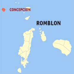 Map of Romblon with Concepcion highlighted | |
.svg.png) Concepcion Location within the Philippines | |
| Coordinates: 12°56′N 121°43′E / 12.93°N 121.71°ECoordinates: 12°56′N 121°43′E / 12.93°N 121.71°E | |
| Country |
|
| Region | Mimaropa (Region IV-B) |
| Province | Romblon |
| District | Lone district |
| Founded | 1570 |
| Barangays | 9 (see Barangays) |
| Government [1] | |
| • Type | Sangguniang Bayan |
| • Mayor | Medrito Fabreag, Jr. [2] |
| • Vice Mayor | Monico Firmalan, Jr. [2] |
| • Electorate | 2,997 voters (2016) |
| Area [3] | |
| • Total | 19.82 km2 (7.65 sq mi) |
| Population (2015 census)[4] | |
| • Total | 4,037 |
| • Density | 200/km2 (530/sq mi) |
| Time zone | UTC+8 (PST) |
| ZIP code | 5516 |
| PSGC | 175905000 |
| IDD : area code | +63 (0)42 |
| Climate type | Tropical climate |
| Income class | 6th municipal income class |
| Revenue (₱) | 37,355,989.21 (2016) |
| Native languages |
Asi language Tagalog |
| Patron saint | Immaculate Conception |
Concepcion, officially the Municipality of Concepcion, is a 6th class municipality in the province of Romblon, Philippines. According to the 2015 census, it has a population of 4,037 people.[4]
History
Early history
Concepcion started as a small village founded in 1570 by the Spanish colonization forces led by Martin de Goiti and Juan de Salcedo, upon orders from then Spanish Governor-General of the Philippines, Miguel Lopez de Legazpi. The village was named after the Immaculate Concepcion. Throughout the Spanish era, the village was administered as part of Banton municipality on nearby Banton Island.[5]
On 2 July 1907, during the American colonization of the Philippines, Concepcion was elevated to municipal status but was incorporated as part of Mindoro province after Romblon was abolished and incorporated as part of Capiz province. However, on 10 March 1917, Romblon was reinstated as a separate province, and thus, Concepcion was incorporated back to the province.[5]
On 8 June 1940, the special municipality of Maghali was established upon passage of Commonwealth Act No. 581 (authored by Congressman Leonardo Festin). This demoted Concepcion and Corcuera from their municipality status and incorporated into the new municipality with its capital in Banton. The special municipality was abolished through the passage of Republic Act No. 38 (authored by Congressman Modesto Formilleza), and by 1 October 1946,[6] Concepcion regained its municipal status which it still holds today.[5]
Proposed secession
Among the islands of Romblon, Concepcion is the farthest from the provincial capital. It is also far from the nearest commercial capital, Odiongan. It takes five hours to travel between Concepcion and Romblon thus making it difficult for provincial executives to visit the island municipality. The nearest municipality from Concepcion is Pinamalayan, Oriental Mindoro, which is only two hours by boat. Hence, most Sibalenhons buy and sell their products in this town instead of Odiongan or Romblon.[7]
In the past, there have been attempts to secede Concepcion from Romblon and re-annex it to Oriental Mindoro. On 16 March 1924, Act No. 3131 was introduced in Congress seeking to re-annex the municipality to Oriental Mindoro but it didn't push through. More recently, in 2014, town mayor Lemuel Cipriano expressed that "90% of Concepcion's 4,500 population are seeking to be re-annexed to Oriental Mindoro". In order to be re-annexed, a resolution calling for a referendum in the island must be filed in Congress by the provincial representative. Oriental Mindoro governor Alfonso Umali Jr. and Second District Congressman Reynaldo Umali have expressed support for a possible referendum.[8]
Former names and territorial changes
| From | Village/Barrio | Town/Municipality/Pueblo | Province |
|---|---|---|---|
As separate district from Capiz*
As fully pledged politico-military province**
Province established by US civilian government***
Geography
Concepcion is located on Maestro de Campo Island (also known as Sibale to its inhabitants) which is the westernmost island of the province and approximately 20 kilometres (12 mi) off the coast from Mindoro. The island is mountainous with steep shores. Its settlements are dispersed along the coast with the poblacion on the south shore. The island's interior is jagged and forested, with caves, clear rivers, unique rock formations, and hills that offer extensive views. Every village has its own cove and white sand beaches which are used for swimming and scuba diving.
Barangays
Concepcion is politically subdivided into 9 barangays.
- Bachawan
- Calabasahan
- Dalajican
- Masudsud
- Poblacion
- Sampong
- San Pedro (Agbatang)
- San Vicente
- Masadya
Demographics
| Population census of Concepcion | ||
|---|---|---|
| Year | Pop. | ±% p.a. |
| 1918 | 1,227 | — |
| 1939 | 1,754 | +1.72% |
| 1948 | 2,187 | +2.48% |
| 1960 | 2,998 | +2.66% |
| 1970 | 4,830 | +4.88% |
| 1975 | 4,997 | +0.68% |
| 1980 | 5,090 | +0.37% |
| 1990 | 4,910 | −0.36% |
| 1995 | 5,126 | +0.81% |
| 2000 | 4,683 | −1.92% |
| 2007 | 4,166 | −1.60% |
| 2010 | 4,445 | +2.39% |
| 2015 | 4,037 | −1.82% |
| Source: Philippine Statistics Authority[4] [9] [10] [11] | ||
According to the 2015 census, it has a population of 4,037 people.[12] Majority of its inhabitants speak the local dialect, Asi, which is also spoken in the nearby islands of Banton and Simara. Sibalenhons, as the islanders call themselves, are predominantly Roman Catholic with a small percentage of Protestants, Jehovah's Witnesses, and Iglesia ni Cristo.
Local government
Pursuant to Chapter II, Title II, Book III of Republic Act 7160 or the Local Government Code of 1991,[13] the municipal government is composed of a mayor (alkalde), a vice vayor (bise alkalde) and members (kagawad) of the legislative branch Sangguniang Bayan alongside a secretary to the said legislature, all of which are elected to a three-year term and are eligible to run for three consecutive terms. Concepcion's incumbent mayor is independent candidate Medrito Fabreag, Jr. while his vice mayor is Monico Firmalan, Jr. from the Nacionalista Party.
The barangays or villages, meanwhile, are headed by elected officials, the topmost being the Punong Barangay or the Barangay Chairperson (addressed as Kapitan; also known as the Barangay Captain). The Kapitan is aided by the Sangguniang Barangay (Barangay Council) whose members, called Barangay Kagawad (Councilors), are also elected.[14]
Tourism
The mountains and the forest offer mountain trekkers new challenges. The beaches have diving spots. Tropical coral reef systems surround the island. Some old folk believe they share the forest and coves with enchanted beings.[15]
Each of the island's nine barangays has its own cove with a palm-fringed white sand beach front. The entire island is visited for its swimming and scuba diving. Notable beaches include those along Tongo point and the beaches between barangay (village) Bachawan and Sampong. The island's interior hills, stretching five to nine kilometer, have trails for hiking and climbing. The island hills are also commonly visited by motor-cross biking enthusiasts. Other places of interest in the island include:[15]
- Mount Banderahan: American soldiers in the early 20th century climbed the island's mountain and planted an American flag. The flagpole, hewed in a big stone, is a landmark sought out by mountain climbers.
- Tinigban Falls: The fall site is a rock formation amid lush greenery. An Old Spanish encomendero once built a mansion here, embedding a mirror into a huge rock so he could have a full view of the waterfalls from his bathroom.
- Matudtod Cave: Ancient skeletal remains and artifacts were found in this cave.
- Quebrada Beach: Quebrada beach facing the town of Concepcion, scalloping the cove with its white sand and wonderful rock formation.
References
- ↑ "Municipality". Quezon City, Philippines: Department of the Interior and Local Government. Retrieved 31 May 2013.
- 1 2 "List of Winners: Municipality of Concepcion". Romblon News. 12 May 2016. Retrieved 30 August 2016.
- ↑ "Province: Romblon". PSGC Interactive. Quezon City, Philippines: Philippine Statistics Authority. Retrieved 12 November 2016.
- 1 2 3 Census of Population (2015). "Region IV-B (Mimaropa)". Total Population by Province, City, Municipality and Barangay. PSA. Retrieved 20 June 2016.
- 1 2 3 Maestro de Campo History Maestro de Campo Dive Resort. Retrieved on 14 April 2012
- ↑ http://laws.chanrobles.com/republicacts/1_republicacts.php?id=38
- ↑ Fallarme, Eufronio (February 2006). "Sibale: A Misannexed Municipality". Sanrokan News Magazine. Retrieved 24 April 2014.
- ↑ Evora, Robert (12 March 2014). "Sibale seeks town cut-off". Manila Standard Today. Retrieved 24 April 2014.
- ↑ Census of Population and Housing (2010). "Region IV-B (Mimaropa)". Total Population by Province, City, Municipality and Barangay. NSO. Retrieved 29 June 2016.
- ↑ Censuses of Population (1903–2007). "Region IV-B (Mimaropa)". Table 1. Population Enumerated in Various Censuses by Province/Highly Urbanized City: 1903 to 2007. NSO.
- ↑ "Province of Romblon". Municipality Population Data. Local Water Utilities Administration Research Division. Retrieved 17 December 2016.
- ↑ "Total Population by Province, City, Municipality and Barangay: as of May 1, 2010" (PDF). 2010 Census of Population and Housing. Philippine Statistics Authority. Archived from the original (PDF) on 15 November 2012. Retrieved 31 January 2013.
- ↑ "An Act Providing for a Local Government Code of 1991". 8th Congress of the Republic of the Philippines. Retrieved April 21, 2014.
- ↑ "The Barangay". Local Government Code of the Philippines. Chan Robles Law Library.
- 1 2 Milex, Fabula (2001). "Profile: Concepcion, Romblon". Archived from the original on 2014-08-14. Retrieved 25 September 2014.
External links
- Philippine Standard Geographic Code
- Philippine Census Information
- Local Governance Performance Management System
- Sibale Online Community
Places adjacent to Concepcion, Romblon | ||||||||||
|---|---|---|---|---|---|---|---|---|---|---|
| ||||||||||