Sant Llorenç des Cardassar
| Sant Llorenç des Cardassar | ||
|---|---|---|
| Municipality | ||
 A view of the bay of s'Illot and Sa Coma | ||
| ||
 Location within Mallorca | ||
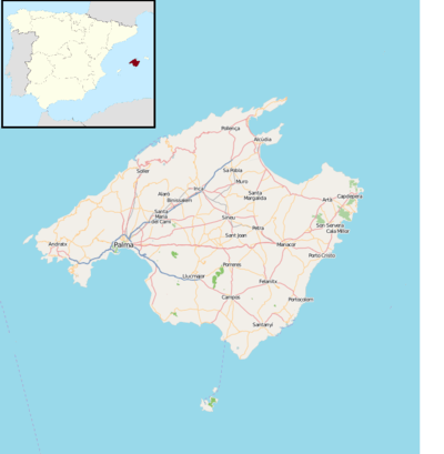 Sant Llorenç des Cardassar Location in Mallorca 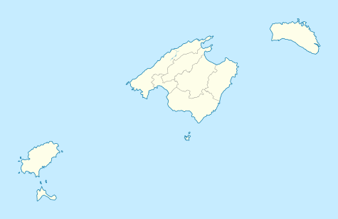 Sant Llorenç des Cardassar Sant Llorenç des Cardassar (Balearic Islands)  Sant Llorenç des Cardassar Sant Llorenç des Cardassar (Spain) | ||
| Coordinates: 39°36′35″N 3°17′02″E / 39.60972°N 3.28389°ECoordinates: 39°36′35″N 3°17′02″E / 39.60972°N 3.28389°E | ||
| Country |
| |
| Autonomous community |
| |
| Province | Balearic Islands | |
| Comarca | Llevant | |
| Judicial district | Manacor | |
| Government | ||
| • Mayor | Mateo Puigrós Sureda | |
| Area | ||
| • Total | 82.08 km2 (31.69 sq mi) | |
| Elevation | 89 m (292 ft) | |
| Population (2009) | ||
| • Total | 8,687 | |
| • Density | 110/km2 (270/sq mi) | |
| Time zone | UTC+1 (CET) | |
| • Summer (DST) | UTC+2 (CEST) | |
| Postal code | 07530 | |
Sant Llorenç des Cardassar (Catalan pronunciation: [ˈsand ʎuˈɾenz ðəs kəɾðəˈsa]) is a small municipality on Mallorca, one of the Balearic Islands, Spain.
History
The Punta de n'Amer Castle was built in the 17th century.[1] Sant Llorenç des Cardassar was part of the municipality of Manacor, until 1892.[1]
Sant Llorenç des Cardassar was the tragic scene of flash floods on the night of October 9th, 2018, in which 12 people died and at least 1 went missing. Some 400 troops of the Spanish Army, Civil Guard, firemen, local police and Civil Protection were mobilized to help trapped people and locate those missing. More than 200 people slept in shelters that were set up for those affected. [2]
Geography
Sant Llorenç is 34 mi (55 km) east of Palma de Mallorca,[3] the island's capital. The municipality, on the eastern coast of the island of Mallorca, adjoins the municipalities of Manacor, Petra, Artà and Son Servera. Inland, the municipality contains the town centre of Sant Llorenç and the village of Son Carrió. On the coast, within the municipality, are Sa Coma, the northern part of s'Illot and the southern part of Cala Millor, which are all beachside tourist areas. The Punta de n'Amer, a headland at the eastern end of the municipality, separates the beaches of Cala Millor and Sa Coma.
Demography
| Historical population | ||||||||||||||||||||||||||||||||||||||||||||||||||
|---|---|---|---|---|---|---|---|---|---|---|---|---|---|---|---|---|---|---|---|---|---|---|---|---|---|---|---|---|---|---|---|---|---|---|---|---|---|---|---|---|---|---|---|---|---|---|---|---|---|---|
|
|
| ||||||||||||||||||||||||||||||||||||||||||||||||
| Note: De jure population Source: [4] | ||||||||||||||||||||||||||||||||||||||||||||||||||
Transport
Roads
The Ma-15, the main road from Palma, acts as a bypass around the southern and eastern sides of the town centre of Sant Llorenç, continuing north through Artà. The Ma-4030 road connects the town centre of Sant Llorenç with Son Servera, to the east. The Ma-4023 road is on an approximate north-south axis, parallel to the coast but about 1 mi (1.6 km) inland from the beach areas, connecting Son Servera with Porto Cristo.
Media
The ITV2 series Love Island is filmed on the outskirts of the town.[5][6]
Notable people
- Margarita Fullana, a mountain biker who won a bronze medal at the 2000 Summer Olympics in Sydney, was born in the municipality.
References
- 1 2 "The town of Sant Llorenç des Cardassar in Majorca". ViaGallica. Retrieved 1 August 2018.
- ↑ "Deadly flash flooding hits Majorca". BBC News. 2018-10-10. Retrieved 2018-10-11.
- ↑ "Coordinate Distance Calculator". Boulter.com. Retrieved 31 July 2018.
- ↑ "Municipio: 07051 Sant Llorenç des Cardassar" [Municipality: 07051 Sant Llorenç des Cardassar]. Instituto Nacional de Estadística (in Spanish). Retrieved 1 August 2018.
- ↑ "Love Island: Where was Jack from? And other questions answered". BBC News. 31 July 2018. Retrieved 31 July 2018.
- ↑ Conroy, Jade; Johnstone, Charlotte (24 July 2017). "Love Island 2017 filming locations revealed". The Telegraph. Retrieved 31 July 2018.
External links
| Wikimedia Commons has media related to Sant Llorenç des Cardassar. |
- Official site (in Catalan)