Es Castell
| Es Castell | |||
|---|---|---|---|
| Municipality | |||
 Cales Fonts | |||
| |||
 Es Castell Location in Menorca  Es Castell Es Castell (Balearic Islands)  Es Castell Es Castell (Spain) | |||
| Coordinates: 39°52′49″N 4°17′27″E / 39.88028°N 4.29083°E | |||
| Country |
| ||
| Autonomous Community |
| ||
| Province | Balearic Islands | ||
| Island | Menorca | ||
| Government | |||
| • Mayor | Josep Lluís Camps Pons (PP) | ||
| Area | |||
| • Total | 11.6 km2 (4.5 sq mi) | ||
| Population (2012) | |||
| • Total | 7,962 | ||
| • Density | 690/km2 (1,800/sq mi) | ||
| Time zone | UTC+1 (CET) | ||
| • Summer (DST) | UTC+2 (CEST (GMT +2)) | ||
| Postal code | 07720 | ||
| Area code(s) | +34 (Spain) + 971 (Baleares) | ||
| Website | Town Hall | ||

Es Castell (Spanish: Villacarlos) is a small municipality in eastern Menorca in the Balearic Islands, Spain. The town was founded in 1771 by British Col. Patrick Mackellar and was originally called Georgetown in honour of King George III; however, it takes its current name from the large fort nearby, known to the British as St. Philip's Castle. Col. Patrick MacKellar (Argyllshire 1717-1778) was the chief engineer of Menorca and his house today is known as Son Granot. Es Castell celebrates its Foundation Day on 1 June with 18th-century themed festivities, in which the Municipality itself, St. Philip's Castle Foundation, Son Granot and other institutions participate.
Gallery
 Municipalities of Menorca
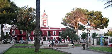 Es Castell town hall
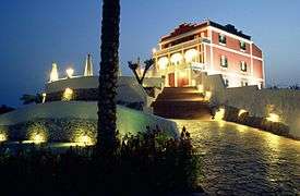 Son Granot
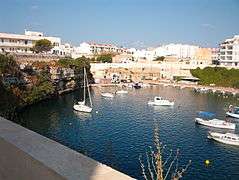 Cala Corb
External links
Coordinates: 39°52′43″N 4°17′24″E / 39.87861°N 4.29000°E
This article is issued from
Wikipedia.
The text is licensed under Creative Commons - Attribution - Sharealike.
Additional terms may apply for the media files.