Sandy Gulch, California
Coordinates: 38°22′49″N 120°31′58″W / 38.38028°N 120.53278°W
| Sandy Gulch | |
|---|---|
| Unincorporated community | |
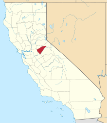
 Sandy Gulch Location in California  Sandy Gulch Sandy Gulch (the US) | |
| Coordinates: 38°22′49″N 120°31′58″W / 38.38028°N 120.53278°W | |
| Country | United States |
| State | California |
| County | Calaveras County |
| Elevation[1] | 2,592 ft (790 m) |
| Population (2016) | |
| • Total | 42 |
| Reference no. | 253 |
Sandy Gulch is a small community in Calaveras County, California, just southwest of West Point on State Route 26. It lies at an elevation of 2592 feet (790 m) above sea level and is located at 38°22′49″N 120°31′58″W / 38.38028°N 120.53278°W. The community is in ZIP code 95248 and area code 209.
It was established in 1849 as a trading center for miners of the area. The settlement, in an area that was home to many Miwok Indians, was named after the gulch where William and Dan Carsner found large nuggets of gold embedded in the coarse sands. Water for mining was brought from the middle fork of the Mokelumne River through Sandy Gulch and Kadish Ditches. Quartz mining began in the early 1850s, and the first custom stamp mill in the district was located at the head of Sandy Gulch. School and election precincts were established early, and one of California's many Hangman's Trees stood near the center of town.
It is registered as California Historical Landmark #253.[2]
Sandy Gulch is marked by a cluster of homes surrounding the town baseball field. Sandy Gulch is also home to several small home businesses. As of 2016, its population was around 42.
Politics
In the state legislature, Sandy Gulch is in the 8th Senate District, represented by Republican Tom Berryhill,[3] and the 5th Assembly District, represented by Republican Frank Bigelow.[4] Federally, Sandy Gulch is in California's 4th congressional district, represented by Republican Tom McClintock.[5]
References
- ↑ U.S. Geological Survey Geographic Names Information System: Sandy Gulch, California
- ↑ "Sandy Gulch". Office of Historic Preservation, California State Parks. Retrieved 2012-10-06.
- ↑ "Senators". State of California. Retrieved March 21, 2013.
- ↑ "Members Assembly". State of California. Retrieved March 21, 2013.
- ↑ "California's 4th Congressional District - Representatives & District Map". Civic Impulse, LLC. Retrieved February 28, 2013.
External links