Lost City, California
Coordinates: 38°05′12″N 120°44′59″W / 38.08667°N 120.74972°W
| Lost City | |
|---|---|
| Unincorporated community | |
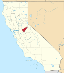
 Lost City Location in California  Lost City Lost City (the US) | |
| Coordinates: 38°05′12″N 120°44′59″W / 38.08667°N 120.74972°W | |
| Country | United States |
| State | California |
| County | Calaveras County |
| Elevation[1] | 1,053 ft (321 m) |
Lost City (formerly Stone City and Stone Creek Settlement) is an unincorporated community in Calaveras County, California, 11 miles (18 km) from Angels Camp along Bear Creek. It lies at an elevation of 1053 feet (321 m). Lost City was constructed in the 1870s by Eugene Barbe.[2] It consists of roughly one dozen stone buildings, which may have been an early Icarian commune (followers of the utopian socialist ideals of Etienne Cabet).[2] The settlement was abandoned by 1896, though a few walls of the original dry-laid field stone buildings remain.[2][3] The ruins are currently on private land.[2]
References
- ↑ U.S. Geological Survey Geographic Names Information System: Lost City, California
- 1 2 3 4 "CAL FIRE Archaeology Program: Archaeological Investigations at Lost City, Calaveras County, California". http://www.calfire.ca.gov/. Cal Fire. Retrieved 22 July 2015. External link in
|website=(help) - ↑ Pisio, Rick. "Lost City Ruins". RWP Photography. Retrieved 22 July 2015.
External links
Further reading
- Durham, David L. (1998). California's Geographic Names: A Gazetteer of Historic and Modern Names of the State. Clovis, Calif.: Word Dancer Press. p. 797. ISBN 1-884995-14-4.
This article is issued from
Wikipedia.
The text is licensed under Creative Commons - Attribution - Sharealike.
Additional terms may apply for the media files.