Sandusky County Regional Airport
| Sandusky County Regional Airport | |||||||||||
|---|---|---|---|---|---|---|---|---|---|---|---|
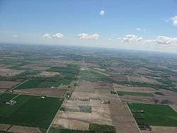 Aerial view of Sandusky County Regional Airport and the surrounding countryside. | |||||||||||
| Summary | |||||||||||
| Airport type | Public | ||||||||||
| Owner | Sandusky County | ||||||||||
| Operator | David Wadsworth | ||||||||||
| Serves | Sandusky County | ||||||||||
| Location | Clyde, Ohio | ||||||||||
| Elevation AMSL | 665 ft / 203 m | ||||||||||
| Coordinates | 41°17′45″N 083°02′14″W / 41.29583°N 83.03722°W | ||||||||||
| Website | www.flys24.com | ||||||||||
| Map | |||||||||||
 S24 Location of airport in Ohio/United States  S24 S24 (the US) | |||||||||||
| Runways | |||||||||||
| |||||||||||
| Statistics (2013) | |||||||||||
| |||||||||||
Sandusky County Regional Airport (FAA LID: S24) is a county-owned public-use airport located five nautical miles (9 km) southeast of the central business district of Fremont, a city in Sandusky County, Ohio, United States.[1]
Facilities and aircraft
Sandusky County Regional Airport has one runway designated 6/24 with a 5,500 by 100 ft (1,676 x 30 m) asphalt pavement. For the 12-month period ending August 16, 2013, the airport had 5,616 aircraft operations, an average of 15 per day: 80% general aviation, 20% air taxi and <1% military. At that time there were 14 aircraft based at this airport: 9 single-engine, 4 multi-engine and 1 helicopter.[1]
References
External links
- Sandusky County Regional Airport Homepage
- FAA Terminal Procedures for S24, effective October 11, 2018
- Resources for this airport:
- FAA airport information for S24
- AirNav airport information for S24
- FlightAware airport information and live flight tracker
- SkyVector aeronautical chart for S24
This article is issued from
Wikipedia.
The text is licensed under Creative Commons - Attribution - Sharealike.
Additional terms may apply for the media files.