Sandon, Victoria
| Sandon Victoria | |
|---|---|
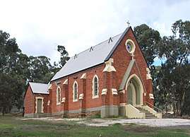 St Laurence O'Toole Roman Catholic church at Sandon | |
 Sandon | |
| Coordinates | 37°10′4″S 144°02′20″E / 37.16778°S 144.03889°ECoordinates: 37°10′4″S 144°02′20″E / 37.16778°S 144.03889°E |
| Population | 81 (2016 census)[1] |
| Postcode(s) | 3462 |
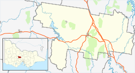
| Location |
|
| LGA(s) | |
| State electorate(s) | Bendigo West |
| Federal Division(s) | Bendigo |
Sandon is a locality in central Victoria, Australia. The locality is split between the Shire of Mount Alexander and the Shire of Hepburn, 106 kilometres (66 mi) north west of the state capital, Melbourne.
At the 2016 census, Sandon had a population of 81.[1]
Sandon's housing range mainly consists of farms of approximately 800 acres each.
References
- 1 2 Australian Bureau of Statistics (27 June 2017). "Sandon (Vic.)". 2016 Census QuickStats. Retrieved 19 July 2017.

External links
![]()
This article is issued from
Wikipedia.
The text is licensed under Creative Commons - Attribution - Sharealike.
Additional terms may apply for the media files.