Sand Ridge Township, Jackson County, Illinois
| Sand Ridge Township | |
|---|---|
| Township | |
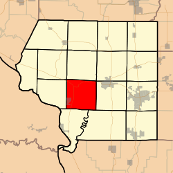 Location in Jackson County | |
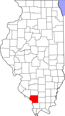 Jackson County's location in Illinois | |
| Coordinates: 37°44′21″N 89°26′18″W / 37.73917°N 89.43833°WCoordinates: 37°44′21″N 89°26′18″W / 37.73917°N 89.43833°W | |
| Country | United States |
| State | Illinois |
| County | Jackson |
| Established | November 4, 1884 |
| Area | |
| • Total | 36.38 sq mi (94.2 km2) |
| • Land | 35.45 sq mi (91.8 km2) |
| • Water | 0.93 sq mi (2.4 km2) 2.56% |
| Elevation | 358 ft (109 m) |
| Population (2010) | |
| • Estimate (2016)[1] | 786 |
| • Density | 23/sq mi (9/km2) |
| Time zone | UTC-6 (CST) |
| • Summer (DST) | UTC-5 (CDT) |
| ZIP codes | 62907, 62940, 62942, 62966 |
| FIPS code | 17-077-67522 |
Sand Ridge Township is one of sixteen townships in Jackson County, Illinois, USA. As of the 2010 census, its population was 816 and it contained 354 housing units.[2]
Geography
According to the 2010 census, the township has a total area of 36.38 square miles (94.2 km2), of which 35.45 square miles (91.8 km2) (or 97.44%) is land and 0.93 square miles (2.4 km2) (or 2.56%) is water.[2]
Cities, towns, villages
Unincorporated towns
- Grimsby at 37°45′01″N 89°26′57″W / 37.750329°N 89.449261°W
- Sand Ridge at 37°44′24″N 89°26′33″W / 37.740051°N 89.442594°W
(This list is based on USGS data and may include former settlements.)
Adjacent townships
- Levan Township (north)
- Somerset Township (northeast)
- Murphysboro Township (east)
- Pomona Township (southeast)
- Grand Tower Township (south)
- Fountain Bluff Township (west)
- Kinkaid Township (northwest)
Cemeteries
The township contains Creath Morris Cemetery.
I believe that the location of the Creath Morris Cemetery is just above the old Grimsby Illinois Elementary School. As a child I lived on the lane that is now called Sarensen. We used to play over on that hill above the school. I don't believe any of the markers are still there because the weather has badly eroded the steep slope. Melissa Janean [Reames] Holt
Major highways
Landmarks
- Lake Murphysboro State Park (southwest edge)
Kincaid Spillway
Notable Persons
Demographics
| Historical population | |||
|---|---|---|---|
| Census | Pop. | %± | |
| Est. 2016 | 786 | [1] | |
| U.S. Decennial Census[4] | |||
School districts
- Murphysboro Community Unit School District 166
- Trico Community Unit School District 176
Political districts
- Illinois' 12th congressional district
- State House District 115
- State Senate District 58
References
- "Sand Ridge Township, Jackson County, Illinois". Geographic Names Information System. United States Geological Survey. Retrieved 2010-01-17.
- United States Census Bureau 2007 TIGER/Line Shapefiles
- United States National Atlas
- 1 2 "Population and Housing Unit Estimates". Retrieved June 9, 2017.
- 1 2 "Population, Housing Units, Area, and Density: 2010 - County -- County Subdivision and Place -- 2010 Census Summary File 1". United States Census. Retrieved 2013-05-28.
- ↑ Gary Geiger
- ↑ "Census of Population and Housing". Census.gov. Retrieved June 4, 2016.
External links
Municipalities and communities of Jackson County, Illinois, United States | ||
|---|---|---|
| Cities | ||
| Villages | ||
| Townships | ||
| CDP | ||
| Other unincorporated communities | ||
| Ghost town | ||
| Footnotes | ‡This populated place also has portions in an adjacent county or counties | |