Makanda Township, Jackson County, Illinois
| Makanda Township | |
|---|---|
| Township | |
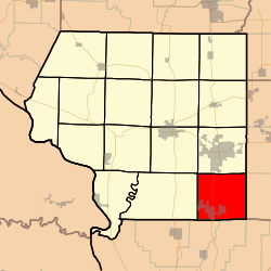 Location in Jackson County | |
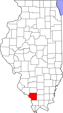 Jackson County's location in Illinois | |
| Coordinates: 37°37′57″N 89°12′50″W / 37.63250°N 89.21389°WCoordinates: 37°37′57″N 89°12′50″W / 37.63250°N 89.21389°W | |
| Country | United States |
| State | Illinois |
| County | Jackson |
| Established | November 4, 1884 |
| Area | |
| • Total | 37.84 sq mi (98.0 km2) |
| • Land | 37.06 sq mi (96.0 km2) |
| • Water | 0.78 sq mi (2.0 km2) 2.06% |
| Elevation | 420 ft (128 m) |
| Population (2010) | |
| • Estimate (2016)[1] | 4,223 |
| • Density | 117.5/sq mi (45.4/km2) |
| Time zone | UTC-6 (CST) |
| • Summer (DST) | UTC-5 (CDT) |
| ZIP codes | 62901, 62920, 62958 |
| FIPS code | 17-077-46227 |
Makanda Township is one of sixteen townships in Jackson County, Illinois, USA. As of the 2010 census, its population was 4,353 and it contained 2,052 housing units.[2]
Geography
According to the 2010 census, the township has a total area of 37.84 square miles (98.0 km2), of which 37.06 square miles (96.0 km2) (or 97.94%) is land and 0.78 square miles (2.0 km2) (or 2.06%) is water.[2]
Cities, towns, villages
- Carbondale (south edge)
- Makanda
Unincorporated towns
- Boskydell at 37°40′16″N 89°12′49″W / 37.671161°N 89.213694°W
- Stone Fort at 37°37′24″N 89°11′48″W / 37.623384°N 89.196749°W
(This list is based on USGS data and may include former settlements.)
Adjacent townships
- Carbondale Township (north)
- Pomona Township (west)
- Murphysboro Township (northwest)
Cemeteries
The township contains these thirteen cemeteries: Boskydell, Evergreen, Hilton, Lirley, Makanda, Rowan, Sheppard, South County Line, Stearns, Union Hills, Wilkins, Zimmerman and Zion.
Major highways
Lakes
- Little Grassy Lake (Illinois)
- Spring Arbor Lake
Landmarks
Demographics
| Historical population | |||
|---|---|---|---|
| Census | Pop. | %± | |
| Est. 2016 | 4,223 | [1] | |
| U.S. Decennial Census[3] | |||
School districts
Unity Point District 140 and Carbondale Community Consolidated High School in Carbondale, IL
Political districts
- Illinois' 12th congressional district
- State House District 115
- State Senate District 58
References
- "Makanda Township, Jackson County, Illinois". Geographic Names Information System. United States Geological Survey. Retrieved 2010-01-17.
- United States Census Bureau 2007 TIGER/Line Shapefiles
- United States National Atlas
- 1 2 "Population and Housing Unit Estimates". Retrieved June 9, 2017.
- 1 2 "Population, Housing Units, Area, and Density: 2010 - County -- County Subdivision and Place -- 2010 Census Summary File 1". United States Census. Retrieved 2013-05-28.
- ↑ "Census of Population and Housing". Census.gov. Retrieved June 4, 2016.
External links
Municipalities and communities of Jackson County, Illinois, United States | ||
|---|---|---|
| Cities | ||
| Villages | ||
| Townships | ||
| CDP | ||
| Other unincorporated communities | ||
| Ghost town | ||
| Footnotes | ‡This populated place also has portions in an adjacent county or counties | |
This article is issued from
Wikipedia.
The text is licensed under Creative Commons - Attribution - Sharealike.
Additional terms may apply for the media files.