Sana (river)
| Sana | |
|---|---|
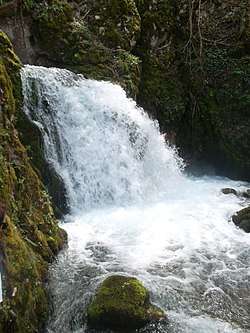
 The Sana river near Donji Vrbljani, Bosnia. | |
| Country | Bosnia and Herzegovina |
| Physical characteristics | |
| Main source | Western Bosnia and Herzegovina |
| River mouth |
Una 45°03′04″N 16°22′59″E / 45.051°N 16.383°ECoordinates: 45°03′04″N 16°22′59″E / 45.051°N 16.383°E |
| Length | 141.9 km (88.2 mi) [1] |
| Basin features | |
| Progression | Una→ Sava→ Danube→ Black Sea |
| Basin size | 4,258 km2 (1,644 sq mi) [1] |
Sana (pronounced [sǎːna]; Cyrillic: Сана) is a river in the north-western part of Bosnia and Herzegovina. It is a tributary of the Una, into which it flows near Novi Grad. It is the longest of the nine rivers that flow through Sanski Most, and is 142 km long. It is not a navigable waterway.
Name
The name of the river derives from the Latin word sana, which means "healthy".
Course
The Sana originates from four springs gushing into a karst plateau of the Bosanska Krajina, near the villages of Pečka and Mrkonjić Grad, not far from the city of Šipovo. After a length of about 1.5 km , these streams meet to form the Sana, which then pass near the town of Ključ in a south-north direction that the river maintains for many kilometers. The river later combines with the waters of its main tributary, the Sanica River. The river then passes through Sanski Most and combines with the river Zdena. The Sana goes through the city of Prijedor, where the Sana combines with the Gomjenica river. The Sana then directs its course to the west until Novi Grad where it flows into the Una river as a tributary. Between Prijedor and Novi Grad, the river serves as a natural border between the two towns of Potkozarje and Podgrmeč.
See also
| Wikimedia Commons has media related to Sana River. |
References
- 1 2 "Sava River Basin Analysis Report" (PDF, 9.98 MB). International Sava River Basin Commission. September 2009. p. 13. Retrieved 2018-05-18.
- This article incorporates text translated from the Serbian Wikipedia article Сана_(ријека), licensed under cc-by-sa.