San Jose, Negros Oriental
| San Jose | |
|---|---|
| Municipality | |
| Municipality of San Jose | |
| Nickname(s): Pineapple Capital of Central Visayas | |
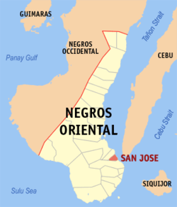 Map of Negros Oriental with San Jose highlighted | |
.svg.png) San Jose Location within the Philippines | |
| Coordinates: 9°25′N 123°14′E / 9.42°N 123.23°ECoordinates: 9°25′N 123°14′E / 9.42°N 123.23°E | |
| Country |
|
| Region | Central Visayas (Region VII) |
| Province | Negros Oriental |
| District | 2nd district of Negros Oriental |
| Founded | 1954 |
| Barangays | 14 (see Barangays) |
| Government [1] | |
| • Type | Sangguniang Bayan |
| • Mayor | Nelson Ruiz |
| • Vice Mayor | Mel Nick Logronio |
| • Electorate | 13,107 voters (2016) |
| Area [2] | |
| • Total | 54.46 km2 (21.03 sq mi) |
| Population (2015 census)[3] | |
| • Total | 20,413 |
| • Density | 370/km2 (970/sq mi) |
| Time zone | UTC+8 (PST) |
| ZIP code | 6202 |
| PSGC | 074617000 |
| IDD : area code | +63 (0)35 |
| Climate type | Tropical climate |
| Income class | 5th municipal income class |
| Revenue (₱) | 63,177,349.33 (2016) |
| Native languages |
Cebuano Tagalog |
San Jose, officially the Municipality of San Jose, is a 5th class municipality in the province of Negros Oriental, Philippines. According to the 2015 census, it has a population of 20,413 people.[3]
Barangays
San Jose is politically subdivided into 14 barangays, shown here with population as of 2015 Census:
- Basak - 827
- Basiao - 673
- Cambaloctot - 652
- Cancawas - 1,746
- Janayjanay - 938
- Jilocon - 1,944
- Naiba - 790
- Poblacion - 939
- San Roque - 942
- Santo Niño - 2,132
- Señora Ascion (Calo) - 1,913
- Siapo - 2,182
- Tampi - 2,058
- Tapon Norte - 2,677
History
The municipality of San Jose was formerly called "Ayuquitan", a name that was born due to a communication problem between the natives and Spanish Conquistadors. The story was that one day a group of Spaniards searching for flourishing communities came upon a group of natives harvesting rice. The Spaniards approached the natives and asked the name of the place while pointing to the ground filled with piles of rice chaffs. The natives thought they were asked for the name of the pile and answered "Inoquitan". From then on, the Spaniards called the place "Inoquitan". In time, the name "Ayuquitan" was adapted from the phrase "may inoquitan". In 1902 Governor Demetrio Larena considered the place as a pueblo. Pioneer Spanish Merchant is Manuel Pastor. San Jose is the home of the old Spanish families settled since 1871 like the Patero, Amiscaray, Larena, Pareja, Siglos, Remollo, Renacia, Remata, Araco and Remoto.
San Jose was created as a town in 1954 from the barrios of Ayuquitan, Basak, Basiao, Cambaloctot, Calo, Cancawas, Hanay-Hanay, Jilocon, Lalaan, Naiba, Tapon Norte, Tampi, and sitios Guinsayawan, Kang-atid, Kangdajonog, Guilongsoran and Kaputihanan of the barrio of Siapo, all of which formerly belonged to the former municipality of Ayuquitan and then part of the municipality of Amlan.[4]
Only Patero, Amiscaray, Pareja and Remoto has Spanish roots. Larenas in San Jose are Chinese, while the Siglos, Remollo, Renacia, Araco are natives of the place (Ayuquitan).
Demographics
| Population census of San Jose | ||
|---|---|---|
| Year | Pop. | ±% p.a. |
| 1960 | 7,547 | — |
| 1970 | 8,840 | +1.59% |
| 1975 | 9,517 | +1.49% |
| 1980 | 10,938 | +2.82% |
| 1990 | 12,821 | +1.60% |
| 1995 | 14,952 | +2.92% |
| 2000 | 15,665 | +1.00% |
| 2007 | 17,250 | +1.34% |
| 2010 | 19,098 | +3.77% |
| 2015 | 20,413 | +1.28% |
| Source: Philippine Statistics Authority[3][5][6][7] | ||
Attractions
The town is the gateway to the Balinsasayao Twin Lakes Natural Park in Enrique Villanueva, Sibulan Town.
One of the tourist attraction of the town was the Our Lady of Lourdes Shrine in the cane fields of Cambaloctot, where a spinning sun is said to have manifested the visit of the Lady of Lourdes, devotees flock every Saturday of the month.
The Ayuquitan Festival is held every May 7, one of the highlights of the town fiesta which is celebrated on May 10. Street dancing and showdown are the main features of the festival.
The St. Paul University Farm is located in Barangay Sra. Acion. The Port of Tampi also serves RORO services going to the island of Cebu through the Port of Bato in the municipality of Samboan.
References
- ↑ "Municipality". Quezon City, Philippines: Department of the Interior and Local Government. Retrieved 31 May 2013.
- ↑ "Province:". PSGC Interactive. Quezon City, Philippines: Philippine Statistics Authority. Retrieved 12 November 2016.
- 1 2 3 Census of Population (2015). "Region VII (Central Visayas)". Total Population by Province, City, Municipality and Barangay. PSA. Retrieved 20 June 2016.
- ↑ "An Act Creating the Municipality of San Jose, Province of Negros Oriental". LawPH.com. Retrieved 2011-04-11.
- ↑ Census of Population and Housing (2010). "Region VII (Central Visayas)". Total Population by Province, City, Municipality and Barangay. NSO. Retrieved 29 June 2016.
- ↑ Censuses of Population (1903–2007). "Region VII (Central Visayas)". Table 1. Population Enumerated in Various Censuses by Province/Highly Urbanized City: 1903 to 2007. NSO.
- ↑ "Province of". Municipality Population Data. Local Water Utilities Administration Research Division. Retrieved 17 December 2016.
External links
- Philippine Standard Geographic Code
- Philippine Census Information
- Local Governance Performance Management System
Places adjacent to San Jose, Negros Oriental | ||||||||||
|---|---|---|---|---|---|---|---|---|---|---|
| ||||||||||