San Carlos, San Diego
| San Carlos, San Diego | |
|---|---|
| Community of San Diego | |
| San Carlos | |
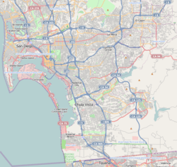 San Carlos, San Diego Location within San Diego | |
| Coordinates: 32°48′31″N 117°01′59″W / 32.808486°N 117.032976°W | |
| Country |
|
| State |
|
| County |
|
| City |
|
San Carlos is an upper-middle-class neighborhood in the eastern area of San Diego, California. It borders the neighborhoods of Del Cerro, Tierrasanta, and Allied Gardens, the city of La Mesa, and Mission Trails Regional Park. The "jewel" of San Carlos is Cowles Mountain.

San Carlos is geographically defined largely by its proximity to Mission Trails Regional Park and to the man-made reservoir Lake Murray. The area consists primarily of single-family homes.
History
The area was developed by Carlos Tavares, after whom it was named.[1]
Government
San Carlos is in the 7th City Council District and is represented by Councilmember Scott Sherman.
Education
The neighborhood is served by the San Diego Unified School District. It contains Daillard Elementary School, Gage Elementary School, Green Elementary School, Benchley/Weinberger Elementary School, Lewis Middle School, Pershing Middle School, and Patrick Henry High School, which serves all three neighboring communities of San Carlos, Allied Gardens, and Del Cerro.
Facilities
Community centers include the city-owned San Carlos Recreation Center, which opened in 1970.[2] There also is a privately owned park known as Del Cerro Park and Pool. There used to be a nonprofit performance venue and community room called Casey's Place, but in 2009 it was closed due to financial problems.[3] It has since become an auto repair shop.
Local newspaper
- Mission Times Courier, community newspaper delivered to and covering San Carlos news.[4]
References
- ↑ kuraoka.org
- ↑ "San Carlos Recreation Center". Park and Recreations. City of San Diego. Retrieved 16 September 2015.
- ↑ San Diego Union Tribune, June 13, 2009
- ↑ http://www.MissionTimesCourier.com missiontimescourier.com
- San Diego County Place Names A to Z - Leland Fetzer (book)
External links
Coordinates: 32°48′31″N 117°01′59″W / 32.808486°N 117.032976°W