Samukawa
| Samukawa 寒川町 | |||
|---|---|---|---|
| Town | |||
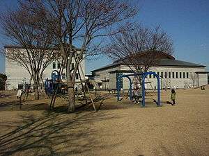 Central Park in Samukawa | |||
| |||
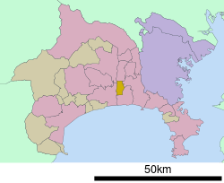 Location of Samukawa in Kanagawa Prefecture | |||
 Samukawa | |||
| Coordinates: 35°22′36″N 139°23′05″E / 35.37667°N 139.38472°ECoordinates: 35°22′36″N 139°23′05″E / 35.37667°N 139.38472°E | |||
| Country | Japan | ||
| Region | Kantō | ||
| Prefecture | Kanagawa Prefecture | ||
| District | Kōza | ||
| Area | |||
| • Total | 13.42 km2 (5.18 sq mi) | ||
| Population (June 12, 2012) | |||
| • Total | 47,445 | ||
| • Density | 3,540/km2 (9,200/sq mi) | ||
| Time zone | UTC+9 (Japan Standard Time) | ||
| - Tree | Osmanthus | ||
| - Flower | Narcissus | ||
| - Bird | Great egret | ||
| Phone number | 0467-74-1111 | ||
| Address | 165 Miyayama, Samukawa-machi, Kōza-gun, Kanagawa-ken 253-0196 | ||
| Website | http://www.town.samukawa.kanagawa.jp/ | ||


Samukawa (寒川町 Samukawa-machi) is a town located in Kanagawa Prefecture, Japan. As of June 2012, the town had an estimated population of 47,445, and a population density of 3,540 persons per km2. The total area is 13.42 km2.
Geography
Samukawa is located in the flatlands of central Kanagawa Prefecture. The Sagami River passes through the town.
Surrounding municipalities
History
The village of Samukawa was founded in 1889. It was linked with Chigasaki Station by the Sagami Line in 1921. A spur line extending from Samukawa to the west led to development of housing and industry, increasing the population of Samukawa such that by 1940 it was granted town status. The Sagami Naval Arsenal of the Imperial Japanese Navy was located in Samukawa until the end of World War II. In 2002, a large quantity of mustard gas was found buried under its former site.
Economy
Samukawa has a mixed economy. Industry includes factories operated by Nissan Kohki, a subsidiary of Nissan Motors producing automotive engines.
Transportation
Railway
Highway
- Ken-Ō Expressway
- Kanagawa Prefectural Routes 44, 45, 46, and 47
Tourist Attraction
- Samukawa Shrine, the first shrine (ichinomiya) of former Sagami Province
External links
| Wikimedia Commons has media related to Samukawa, Kanagawa. |
- Official Website (in Japanese)
| Wards of Yokohama | ||
|---|---|---|
| Wards of Kawasaki | ||
| Wards of Sagamihara | ||
| Core city | ||
| Special cities | ||
| Cities | ||
| Districts | ||