Salisbury, Pennsylvania
| Salisbury, Pennsylvania | |
|---|---|
| Borough | |
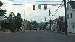 Grant Street, downtown | |
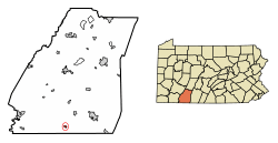 Location of Salisbury in Somerset County, Pennsylvania. | |
 Salisbury Location of Salisbury in Somerset County, Pennsylvania.  Salisbury Salisbury (the US) | |
| Coordinates: 39°49′05″N 79°04′59″W / 39.81806°N 79.08306°WCoordinates: 39°49′05″N 79°04′59″W / 39.81806°N 79.08306°W | |
| Country | United States |
| State | Pennsylvania |
| County | Somerset |
| Settled | 1794 |
| Incorporated | 1862 |
| Government | |
| • Type | Borough Council |
| Area[1] | |
| • Total | 0.38 sq mi (0.99 km2) |
| • Land | 0.38 sq mi (0.99 km2) |
| • Water | 0.00 sq mi (0.00 km2) |
| Elevation | 2,114 ft (644 m) |
| Population (2010) | |
| • Total | 727 |
| • Estimate (2016)[2] | 693 |
| • Density | 1,809.40/sq mi (697.84/km2) |
| Time zone | UTC-5 (Eastern (EST)) |
| • Summer (DST) | UTC-4 (EDT) |
| Zip code | 15558 |
| Area code(s) | 814 |
| FIPS code | 42-67584 |
| Website | http://salisburypa.net/ |
Salisbury is a borough in Somerset County, Pennsylvania, United States. The population was 878 at the 2000 census. It is part of the Johnstown, Pennsylvania Metropolitan Statistical Area.
History
Salisbury was founded in 1794 by Joseph Markley,[3] and was located on the Turkey Foot Road.[4] In 1998, Salisbury was hit by two F3 tornadoes on May 31 and June 2. The May 31 tornado killed one person and injured 15 others and the June 2 tornado intensified into an F4 tornado when it struck Allegany County, Maryland.[5]
Geography
Salisbury is located at 39°45′5″N 79°4′59″W / 39.75139°N 79.08306°W (39.751455, -79.083076).[6]
According to the United States Census Bureau, the borough has a total area of 0.4 square miles (1.0 km2), all of it land.
Demographics
| Historical population | |||
|---|---|---|---|
| Census | Pop. | %± | |
| 1870 | 291 | — | |
| 1880 | 521 | 79.0% | |
| 1890 | 689 | 32.2% | |
| 1900 | 980 | 42.2% | |
| 1910 | 885 | −9.7% | |
| 1920 | 951 | 7.5% | |
| 1930 | 710 | −25.3% | |
| 1940 | 919 | 29.4% | |
| 1950 | 865 | −5.9% | |
| 1960 | 862 | −0.3% | |
| 1970 | 895 | 3.8% | |
| 1980 | 817 | −8.7% | |
| 1990 | 716 | −12.4% | |
| 2000 | 878 | 22.6% | |
| 2010 | 727 | −17.2% | |
| Est. 2016 | 693 | [2] | −4.7% |
| Sources:[7][8][9] | |||
As of the census[8] of 2000, there were 878 people, 350 households, and 218 families residing in the borough. The population density was 2,203.6 people per square mile (847.5/km²). There were 368 housing units at an average density of 923.6 per square mile (355.2/km²). The racial makeup of the borough was 99.66% White, and 0.34% from two or more races. Hispanic or Latino of any race were 0.80% of the population.
There were 350 households out of which 26.0% had children under the age of 18 living with them, 49.7% were married couples living together, 8.6% had a female householder with no husband present, and 37.7% were non-families. 33.7% of all households were made up of individuals and 21.1% had someone living alone who was 65 years of age or older. The average household size was 2.44 and the average family size was 3.07.
In the borough the population was spread out with 23.6% under the age of 18, 5.8% from 18 to 24, 25.9% from 25 to 44, 23.0% from 45 to 64, and 21.8% who were 65 years of age or older. The median age was 41 years. For every 100 females there were 89.6 males. For every 100 females age 18 and over, there were 83.8 males.
The median income for a household in the borough was $26,875, and the median income for a family was $36,188. Males had a median income of $30,682 versus $17,222 for females. The per capita income for the borough was $12,973. About 10.6% of families and 18.3% of the population were below the poverty line, including 21.7% of those under age 18 and 14.1% of those age 65 or over.
References
- ↑ "2016 U.S. Gazetteer Files". United States Census Bureau. Retrieved Aug 14, 2017.
- 1 2 "Population and Housing Unit Estimates". Retrieved June 9, 2017.
- ↑ “History of Bedford, Somerset and Fulton Counties, Pennsylvania”, 1884.
- ↑ L. Dietle & M. McKenzie. “In Search of the Turkey Foot Road.” Mount Savage Historical Society, 2010.
- ↑ http://www.tornadohistoryproject.com
- ↑ "US Gazetteer files: 2010, 2000, and 1990". United States Census Bureau. 2011-02-12. Retrieved 2011-04-23.
- ↑ "Census of Population and Housing". U.S. Census Bureau. Retrieved 11 December 2013.
- 1 2 "American FactFinder". United States Census Bureau. Retrieved 2008-01-31.
- ↑ "Incorporated Places and Minor Civil Divisions Datasets: Subcounty Resident Population Estimates: April 1, 2010 to July 1, 2012". Population Estimates. U.S. Census Bureau. Archived from the original on 17 June 2013. Retrieved 11 December 2013.
External links
Municipalities and communities of Somerset County, Pennsylvania, United States | ||
|---|---|---|
| Boroughs | 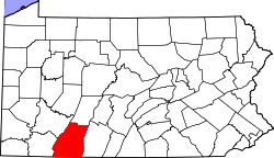 | |
| Townships | ||
| CDPs | ||
| Unincorporated communities | ||
| Footnotes | ‡This populated place also has portions in an adjacent county or counties | |