Saligrama, Mysore
| Saligrama ಸಾಲಿಗ್ರಾಮ | |
|---|---|
| Hobli | |
 Saligrama Location in Karnataka, India  Saligrama Saligrama (India)  Saligrama Saligrama (Asia) .svg.png) Saligrama Saligrama (Earth) | |
| Coordinates: 12°33′42″N 76°15′48″E / 12.561715°N 76.263292°ECoordinates: 12°33′42″N 76°15′48″E / 12.561715°N 76.263292°E | |
| Country |
|
| State |
|
| District | Mysuru |
| Saligramam | 1096 CE |
| Founded by | Sri Ramanujacharya |
| Government | |
| • Body | Gram Panchayat |
| Area | |
| • Total | 11.095 km2 (4.284 sq mi) |
| Elevation | 788 m (2,585 ft) |
| Population (2011) | |
| • Total | 11,836 |
| • Density | 1,067/km2 (2,760/sq mi) |
| Languages | |
| • Official | Kannada |
| Time zone | UTC+5:30 (IST) |
| PIN | 571 604 |
| Telephone code | +91-8223 [08223] |
| ISO 3166 code | IN-KA |
| Website |
karnataka |
Saligrama (ಸಾಲಿಗ್ರಾಮ)[1][2][3] is the 5th biggest village by area in the sub district and is situated on the north bank of the river Cauvery [Kaveri], this place is esteemed as sacred by the Shri Vaishnavas on account of its having been the residence of Sri Ramanujacharya. It is a hobli with PIN code 571604[4], is in K R Nagara [Krishnarajanagara] taluk, in the Mysuru district [Mysore district] of Karnataka, India.
A number of religious sites, famous old temples - including Sri Yoga Narasimha Swamy Temple[5], Jain Basadis, and an Ashram are located in here.
History
Swamy Ramanuja arrived in Karnataka where the local tribals received him in this place. The local people who were averse to Swamy Ramanuja conspired a plan to do away with him. Swamy Ramanuja learning their evil intentions ordered Mudaliandan Swamy to place his feet in the drinking water pond in that area now called Saligrama. At Saligrama, by partaking this Sripada theertham, the minds of the evildoers changed and they fell at Swamy Ramanuja lotus feet seeking forgiveness. Such was the greatness of our Mudaliandan Swamy.
When persecuted by the Chola king Kulottunga, Ramanuchacharya is said to have fled the Chola countey and first stayed at Vahnipushkarini (the place now known as 'Mirle') from where he moved on to Saligrama.
Etymology
Swamy Ramanuja named this place as "Saligramam" which is near Melkote. Even today this pond is maintained by the archakas who ensures that no intruder pollutes the pond by locking the gate. There is a small temple opposite to this pond in which Swamy Ramanuja's Thiruvadi chuvadugal are worshipped. There is also a deity of Swamy Ramanuja in Sesharoopa near the garbagriha.
Demographics
Population
According to census data released in 2011[6] by the Government of Karnataka, total area of Saligrama is spread across 1109.5 hectares with a total population of 11836 persons [Male - 5869 and Female - 5967] and 2976 households with an average of 4 persons per household.
Gender Wise Population
Literacy
As per the report the total literacy rate is 71.93% [with Male - 77.33% and Female - 66.59%]. Comparing it with the previous census data, the total literacy rate has increased by 6% with 4% increase in the male and 7% increase in the female literacy rate.[7]
Growth in Population
Presently, there is a 0.5% increase in the total population of the village as it was about 12000 before 10 years. The rate of growth in female population has gone up by 2.9% and male population has decreased by -1.9%. So, the rate of population growth in female is 4.8% higher compared to their counterpart.[7]
Sex Ratio
According to the recent census, there are 1017 females per 1000 males. The overall sex ratio has gone up by 47 females per 1000 males during the period of 10 years. The Child sex ratio here has also increased by 170 girls per 1000 boys at the same duration. For the age group of below 6 years, there are 1060 girls per 1000 boys.[7]
Work Profile
out of total population, 41% are engaged either in main work or in marginal works - 62% male [55% full time and 7% part time] and 20% female [14% are full time and 7% are marginal] are working.[7]
Land Usage
| Types of land use | Area (in hectares) |
|---|---|
| Current Fallows | 8.2 |
| Net Area Sown | 890.9 |
| Total Irrigated Land Area | 541.5 |
| Total Un-irrigated Land Area | 349.4 |
| Canals | 510 |
| Wells/Tube-wells | 31.5 |
Education
There is a Public library, common reading rooms along with newspapers and magazines supplies on a daily basis.
- Pre-Primary school - 1
- Primary school - 9
- Middle school - 8
- Secondary School - 2
- Senior Secondary school - 3
- Degree College of Arts, Science & Commerce - 2
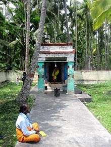
Temples
- Sri Yoganarasimha Swamy Temple
- Jyothirmaheshwara Temple
- Sri Ramanuja Sripada Teertham and Temple
- Hanuman Temple
- Kote Anjaneya
- Ganapati Temple
- Shaneshwara Swamy Temple
- Kalikamba Temple
- Basadi [Jain Temple] - Ancient Shri 1008 Bhagwan Neminath Digambar Jain Temple
Banks & ATMs
- State Bank of India [SBI]
- Karnataka Bank
- ((KAVERI GRAMEENA BANK)) (KGB)
Also, many ATMs are placed for the convenience of their customers.
Postal and Courier Services
A public Post-office is situated and there are many private courier services available here, also, e-market (Amazon, Flipkart, Myntra) product delivery services are rendered on a daily basis.
Petrol Pumps
There are 3 petrol pumps which are available within this location.
Transportation
Roadways
A public bus stand along with the private facilities such as - buses, taxies, auto-rickshaws, which makes transportation connectivity easier.
Healthcare
A government hospital and many private clinics are situated. Also, there are 5 Medicine shops.
Law & Order
There is a Police-Station located to maintain the law and order, it also covers the small neighboring villages.
Other Facilities
- Internet cafes
- Cinema halls
Notable People
- Parvathamma Rajkumar, Kannada film industry producer
- Sa Ra Mahesh, Politician
- Bhavani Revanna, Politician
- S. A. Chinne Gowda, Kannada film producer and distributor
Directions
- From the district, Mysore [Mysuru] - it is located 70 km away, nearly 1.5 hrs journey. (Google Map directions link here)
- From Hassan - located 60 km away, approximately 1.5 hrs journey. (link here)
- From the state capital, Banglore [Bengaluru] - almost 200 km away, takes 3.5 hrs journey. (link here)
- From the taluk, K R Nagara [Krishnarajanagara] - only takes 30 mins of travel for 21 km. (link here)
- From Holenarasipura - barely 27 km with 40 mins of journey. (link here)
- From Hunsur - takes about 1 hr for 40 km of travel. (link here)
- From Konanur - it is about 28 km, 1 hr journey. (link here)
Declaration by the Authors
The statistical figures produced above are as per the 2011 census report released by the Government of Karnataka under the Government of India, hence most of the data may only be relevant to that corresponding year. If you are looking for an accurate information for any of the later years, then it may need some corrections [omissions / updating / insertions].
Photo Gallery
 Hanuman temple
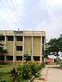 Saligrama Girls College
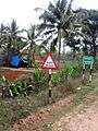 Village entrance
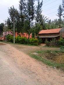 Keralapura village
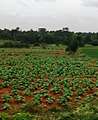 Dadada village
 Yoga Narasimha Swamy Temple
See also
References
- ↑ "Saligrama , ಕನ್ನಡ". wikiedit.org. Retrieved 2018-07-30.
- ↑ "Saligrama Village in Krishnarajanagara (Mysore) Karnataka | villageinfo.in". villageinfo.in. Retrieved 2018-07-30.
- ↑ "Saligrama Village Population - Krishnarajanagara - Mysore, Karnataka". www.census2011.co.in. Retrieved 2018-07-30.
- ↑ "Pin Code: 571604, List of Post Offices, MYSORE, KARNATAKA Pincode.net.in". pincode.net.in. Retrieved 2018-07-30.
- ↑ "Sri Yoganarasimha Swamy Temple".
- ↑ "Saligrama Village Population - Krishnarajanagara - Mysore, Karnataka". www.census2011.co.in. Retrieved 2018-08-05.
- 1 2 3 4 "Saligrama Village". indikosh.com. Retrieved 2018-08-01.