Konanur, Hassan
| Konanur | |
|---|---|
| town | |
 Konanur | |
 Konanur Location in Karnataka, India  Konanur Konanur (India) | |
| Coordinates: 12°38′N 76°03′E / 12.633°N 76.050°ECoordinates: 12°38′N 76°03′E / 12.633°N 76.050°E | |
| Country |
|
| State | Karnataka |
| District | Hassan |
| Talukas | Arkalgud |
| Population (2011) | |
| • Total | 15,565 |
| Languages | |
| • Official | Kannada |
| Time zone | UTC+5:30 (IST) |
Konanur is a mid level town in the southern state of Karnataka, India.[1][2] It is located in the Arkalgud taluk of Hassan district in Karnataka.
Demographics
As of 2001 India census, Konanur had a population of roughly 9702 with 4890 males and 4812 females,konanur is located on the shore of river cauvery and it is located in state highway SH85 & SH95 in border of hassan district as trianguler border it covers from kodagu and mysore districts. .[1]
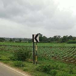
Image gallery
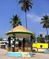 Ambedkar Circle
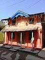 Kumbaleshwara temple
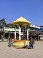 Gandhi circle
Villages of konanuru
- Doddabommenahalli
- Chikkabommenhalli
- Siddapura gate
- Saraguru
- Banugondi
- Ullenahalli
- Siddapura
- Handrangi
- Shigodu
- Arasikatte Kaval
- Chikkahalli
- Kerekodi
- Kaduvina Hosahalli
- Kesavatthur
- Bidarur
See also
References
- 1 2 Village code= 2620800 "Census of India : Villages with population 5000 & above". Registrar General & Census Commissioner, India. Archived from the original on December 8, 2008. Retrieved 2008-12-18.
- ↑ "Yahoomaps India :". Archived from the original on 18 December 2008. Retrieved 2008-12-18. Konanur, Hassan, Karnataka
External links
District HQ: Hassan | |
| Villages and Towns |
|
This article is issued from
Wikipedia.
The text is licensed under Creative Commons - Attribution - Sharealike.
Additional terms may apply for the media files.