Hunsur
| Hunasuru TimberLand | |
|---|---|
| city | |
| Nickname(s): GaadiPalya | |
 Hunasuru Location in Karnataka, India | |
| Coordinates: 12°18′38″N 76°16′49″E / 12.3105671°N 76.2802055°ECoordinates: 12°18′38″N 76°16′49″E / 12.3105671°N 76.2802055°E | |
| Country |
|
| State | Karnataka |
| District | Mysore |
| Elevation | 792 m (2,598 ft) |
| Population (2001) | |
| • Total | 43,893 |
| Languages | |
| • Official | Kannada |
| Time zone | UTC+5:30 (IST) |
| PIN | 571 105 |
| Telephone code | 08222 |
| Vehicle registration | KA-45( Includes neaby places like K R Nagar,Periyaptna and H D Kote) |
| Website |
www |
Hunsur is town in Mysore district in the Indian state of Karnataka. It is the headquarter of the Hunsur Taluk administrative division.

Location
Hunsur is situated on the western side of Mysore city on the way to Virajpet town. Madikeri also lies on the western side of Hunsur on another road. Hassan lies on the northern side of Hunsur and H.D.Kote town is on the southern side. Hunsur lies on NH-275 and connects Bangalore to the Nagarahole National Park , Madikeri , Kodagu and Mangalore. Adaguru H Vishwanath is the present MLA of hunsur [1][2]
History
Its main claim to fame was that former Chief minister of Karnataka state Sri D. Devaraj Urs hailed from this constituency. The well known film director Hunsur Krishnamurthy also hailed from here.
Economy
Hunsur is also well known for timber trade, especially teak. Hunsur Teak is noted for its quality and durability; Another important trade activity is tobacco growing and tobacco auctions. Consolidated Coffee Curing Works employs many people in coffee bean processing. This location is also a growing market for sheep farming. Farmlands are spread in abundance in this beautiful town.
Education
There are several educational institutions, including the Government First Grade College, established through the efforts of D. Devaraja Urs and St.Joseph School and College..
Geography
Hunsur is located at 12°19′N 76°17′E / 12.31°N 76.29°E.[3] It has an average elevation of 792 metres (2598 feet). The river Lakshmana Tirtha flows through the town and is crossed by two bridges. The town is the administrative centre of Hunsur taluk, which is part of Mysore District.
Etymology
This town used to be called 'Gaadi Palya', meaning 'a resting station for bullock carts' (before the arrival of automobiles), probably en route to Mysore, the nearest city 47 kilometres away. Hunsur is the best place to get settled for all officials who are working in Mysore because its one of the coolest places of Karnataka and just 45 minutes from mysore. Famous Kannada actor turned producer and director Dwarkish, and popular director Bargava and famous Kannada director Hunsur Krishnamurthy hailed from Hunsur. Nagarhole sanctuary is only 47 km away from Hunsur.
Demographics
As of 2001 India census,[4] Hunsur had a population of 43,893. Males constitute 51% of the population and females 49%. Hunsur has an average literacy rate of 69%, higher than the national average of 59.5%: male literacy is 74%, and female literacy is 63%. In Hunsur, 12% of the population is under six years of age. Nearby villages include Harave, Kallahalli, Kattemalal vadi, Bilikere, Yamagumba, and Chilkunda.
Suburbs and villages
- Krishnapura
- Hosaramanahalli
- Kattemalala vadi
- Hanagudu
- Kamagowdna halli
- Vaddambalu
- Thattekere
- Niluvagilu
- Veeranahosalli Village
- Yelwala
- Bilikere Town
- Bannikuppe village
- Kadnakoppalave
- Kallali village
- Panchavalli
- Kokkare Hosalli
- Muddena Halli
- Gowripura
- Hirekyathanahall
- Honnenahalli
- Marigudi street
See also
Image gallery
 Muthrani Hosanya Kaval
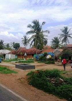
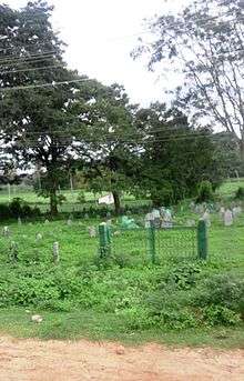 Panchavalli, Hunsur
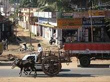
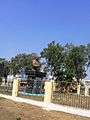 Hunsur town
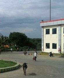
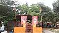 Temple near KSRTC
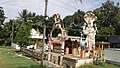 Temple near Depot
References
- ↑ "Seven state highways to be upgraded to national highways". Daijiworld. 7 May 2014. Retrieved 14 May 2017.
- ↑ "Revised tender boosts 6-lane B'luru-Mysuru road project". Deccan Herald. 2 March 2017. Retrieved 14 May 2017.
- ↑ Falling Rain Genomics, Inc - Hunsur
- ↑ "Census of India 2001: Data from the 2001 Census, including cities, villages and towns (Provisional)". Census Commission of India. Archived from the original on 2004-06-16. Retrieved 2008-11-01.
| Wikimedia Commons has media related to Hunsur. |