Holenarasipura
| Holenarasipura Hole Narsipura | |
|---|---|
| Town | |
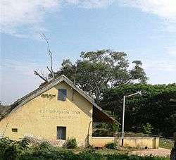 Old Railway Station | |
 Holenarasipura Location in Karnataka, India | |
| Coordinates: 12°46′59″N 76°14′35″E / 12.783°N 76.243°ECoordinates: 12°46′59″N 76°14′35″E / 12.783°N 76.243°E | |
| Country |
|
| State | Karnataka |
| District | Hassan |
| Government | |
| • MLA | H. D. Revanna |
| Area | |
| • Total | 2.50 km2 (0.97 sq mi) |
| Elevation | 849 m (2,785 ft) |
| Population (2001) | |
| • Total | 27,018 |
| • Density | 10,807.2/km2 (27,991/sq mi) |
| Languages | |
| • Official | Kannada |
| Time zone | UTC+5:30 (IST) |
| PIN | 573 211 |
| Telephone code | +91-8175 |
| ISO 3166 code | IN-KA |
| Vehicle registration | KA-13 |
| Website |
karnataka |
Holenarasipura is a town and taluk in Hassan district of Karnataka. The town is situated on the banks of the Hemavati, one of the many tributaries of the Kaveri.
Demographics
As of 2001 India census,[1] Holenarasipura had a population of 27,018. Males constitute 51% of the population and females 49%. It has an average literacy rate of 73%, higher than the national average of 59.5%; with male literacy of 78% and female literacy of 68%. 11% of the population is under 6 years of age.
Location
Holenarasipura is on a state highway between Mysore and Hassan and on another state highway between Somavarapete and Bangalore. It is connected to the rest of Karnataka and India by broad gauge railway. It is 32 km from Hassan, 90 km from Mysore, 175 km from Bangalore and 201 km from Mangalore.
Prominent Persons
- Satchidanandendra Saraswati, philosopher, Advaita and Vedanta thinker.
- H. D. Deve Gowda, Former Prime Minister of India.
- H. D. Kumaraswamy, Chief Minister of Karnataka.
- H. D. Revanna, politician
See also
References
- ↑ "Census of India 2001: Data from the 2001 Census, including cities, villages and towns (Provisional)". Census Commission of India. Archived from the original on 2004-06-16. Retrieved 2008-11-01.
External links
| Wikimedia Commons has media related to Holenarasipura. |