Salem Township, Carroll County, Illinois
| Salem Township | |
|---|---|
| Township | |
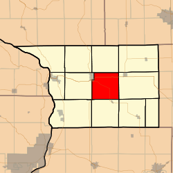 Location in Carroll County | |
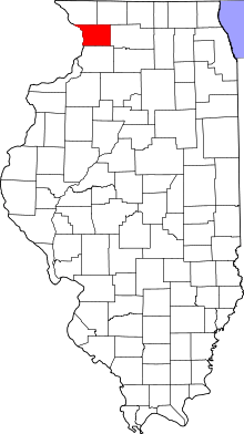 Carroll County's location in Illinois | |
| Coordinates: 42°03′38″N 89°55′25″W / 42.06056°N 89.92361°WCoordinates: 42°03′38″N 89°55′25″W / 42.06056°N 89.92361°W | |
| Country | United States |
| State | Illinois |
| County | Carroll |
| Government | |
| • Supervisor | Merlyn Schreiner |
| Area | |
| • Total | 35.57 sq mi (92.1 km2) |
| • Land | 35.56 sq mi (92.1 km2) |
| • Water | 0.01 sq mi (0.03 km2) 0.03% |
| Elevation | 797 ft (243 m) |
| Population (2010) | |
| • Estimate (2016)[1] | 330 |
| • Density | 9.8/sq mi (3.8/km2) |
| Time zone | UTC-6 (CST) |
| • Summer (DST) | UTC-5 (CDT) |
| ZIP codes | 61014, 61046, 61053 |
| FIPS code | 17-015-67210 |
Salem Township is one of twelve townships in Carroll County, Illinois, USA. As of the 2010 census, its population was 348 and it contained 169 housing units.[2]
Geography
According to the 2010 census, the township has a total area of 35.57 square miles (92.1 km2), of which 35.56 square miles (92.1 km2) (or 99.97%) is land and 0.01 square miles (0.026 km2) (or 0.03%) is water.[2]
Cities, towns, villages
- Mount Carroll (east quarter)
Unincorporated towns
- Ashdale Junction
- Daggett (historical)
(This list is based on USGS data and may include former settlements.)
Cemeteries
The township contains these three cemeteries: Adams-Daggert, Oakville and Trinity Evangelical Lutheran.
Major highways
Airports and landing strips
- Tautz Brothers Airport
- Williard Nycum RLA Airport
Demographics
| Historical population | |||
|---|---|---|---|
| Census | Pop. | %± | |
| Est. 2016 | 330 | [1] | |
| U.S. Decennial Census[3] | |||
School districts
- Chadwick-Milledgeville Community Unit School District 399
- Eastland Community Unit School District 308
- West Carroll Community Unit School District 314
Political districts
- Illinois' 17th congressional district
- State House District 71
- State Senate District 36
References
- "Salem Township, Carroll County, Illinois". Geographic Names Information System. United States Geological Survey. Retrieved 2010-01-04.
- United States Census Bureau 2007 TIGER/Line Shapefiles
- United States National Atlas
- 1 2 "Population and Housing Unit Estimates". Retrieved June 9, 2017.
- 1 2 "Population, Housing Units, Area, and Density: 2010 - County -- County Subdivision and Place -- 2010 Census Summary File 1". United States Census. Retrieved 2013-05-28.
- ↑ "Census of Population and Housing". Census.gov. Retrieved June 4, 2016.
External links
Places adjacent to Salem Township, Carroll County, Illinois | |
|---|---|
Municipalities and communities of Carroll County, Illinois, United States | ||
|---|---|---|
| Cities | ||
| Villages | ||
| Townships | ||
| Unincorporated communities | ||
| Ghost town | ||
| Footnotes | ‡This populated place also has portions in an adjacent county or counties | |
This article is issued from
Wikipedia.
The text is licensed under Creative Commons - Attribution - Sharealike.
Additional terms may apply for the media files.