Salem Creek (Ontario)
| Salem Creek | |
| River | |
| Country | Canada |
|---|---|
| Province | Ontario |
| Region | Central Ontario |
| County | Northumberland |
| Municipality | Cramahe |
| Part of | Great Lakes Basin |
| Source | Unnamed field |
| - elevation | 146 m (479 ft) |
| - coordinates | 42°02′15″N 77°50′50″W / 42.03750°N 77.84722°W |
| Mouth | Lake Ontario |
| - elevation | 74 m (243 ft) |
| - coordinates | 44°00′00″N 77°49′54″W / 44.00000°N 77.83167°WCoordinates: 44°00′00″N 77°49′54″W / 44.00000°N 77.83167°W |
| Length | 5 km (3 mi) |
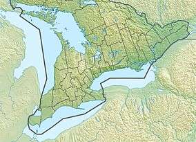 Location of the mouth of the creek in southern Ontario | |
Salem Creek is a stream in the municipal township of Cramahe, Northhumberland County in Central Ontario, Canada.[1][2][3] It is in the Great Lakes Basin and is a tributary of Lake Ontario. The creek takes its name from the community of Salem which it flows past.
Salem Creek begins in a field just south of Ontario Highway 401 and flows south, past Salem Hill[4] and the community of Salem. It heads under County Road 2 (formerly Ontario Highway 2), under the Canadian National Railway and Canadian Pacific Railway mainlines, and reaches its mouth at Lake Ontario.
References
- ↑ "Salem Creek". Geographical Names Data Base. Natural Resources Canada. Retrieved 2017-03-18.
- ↑ Map 6 (PDF) (Map). 1 : 700,000. Official road map of Ontario. Ministry of Transportation of Ontario. 2016-01-01. Retrieved 2017-03-18.
- ↑ Restructured municipalities - Ontario map #5 (Map). Restructuring Maps of Ontario. Ontario Ministry of Municipal Affairs and Housing. 2006. Retrieved 2017-03-18.
- ↑ "Salem Hill". Geographical Names Data Base. Natural Resources Canada. Retrieved 2017-03-18.
This article is issued from
Wikipedia.
The text is licensed under Creative Commons - Attribution - Sharealike.
Additional terms may apply for the media files.